Good morning from Southern Connecticut Weather
Rain!
Rain and breezy conditions have overspread the state, as moisture from post-tropical cyclone Matthew, an advancing cold front, and strong low level jet are pushing through the state. Apologies for the northwest folks who are getting flashbacks from winter, but the best precipitation has been focused across southern Connecticut.
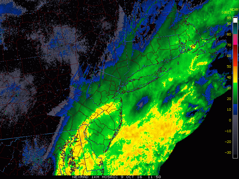
Current radar loop of the rain over Connecticut today.
Sunday
Although we've started off rainy, I expect dry but cloudy conditions to slowly advance through the state as the cold front moves through. In its wake, it will be breezy as a sharp pressure gradient sets up as a wave of low pressure develops along the front. For those few looking for a beach day on this long weekend, we expect rough surf today and tonight with a rip current risk.
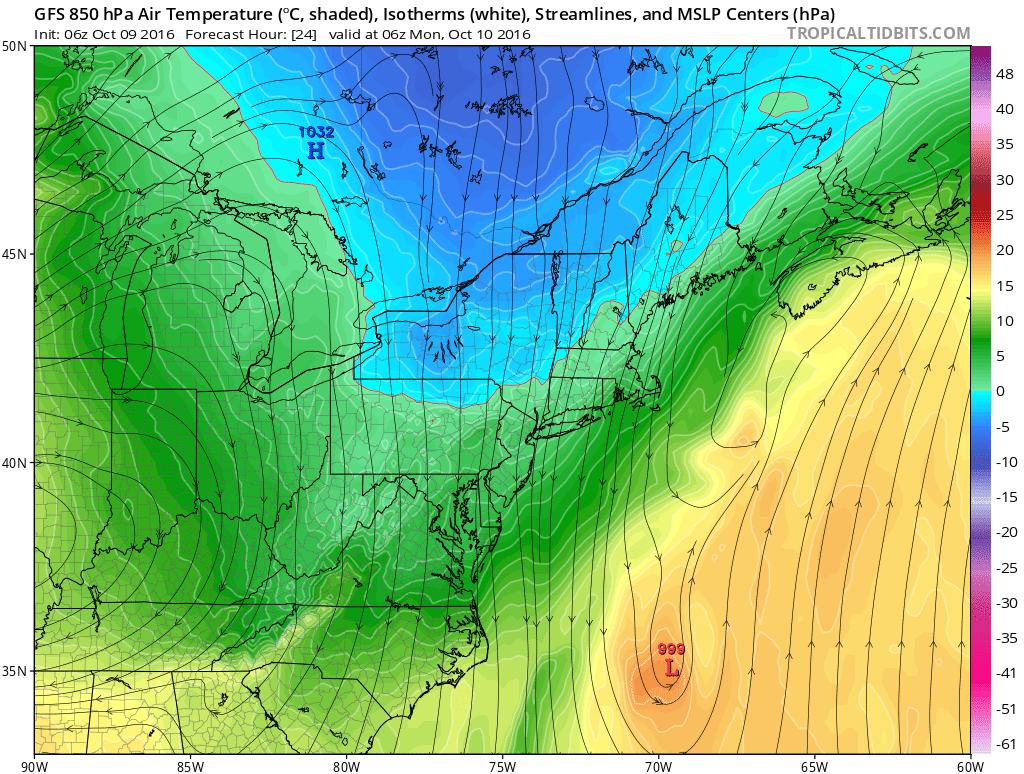
GFS depiction of 850mb temperatures late tonight and early tomorrow morning. With clearing skies late tonight, we expect temperatures in the mid 30s to low 40s in our warmer spots.
Columbus Day
For those fortunate enough to get a day off, tomorrow looks beautiful. It may be a bit breezy early, but expect sunny skies and cool temperatures. Tomorrow night looks clear and seasonably cold, with temperatures in the 30s even in the cities. I think we have plenty of potential to see frost, especially in traditionally colder spots.
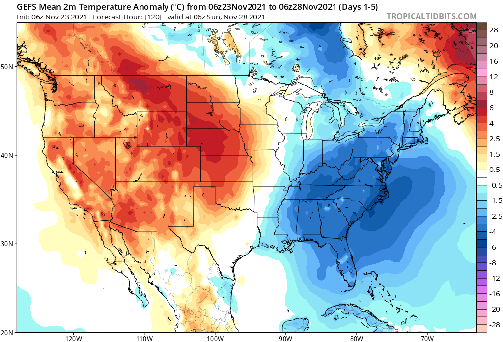
GEFS temperature anomaly depiction for the next five days. Cool nights drive the temperature departure.
Tuesday through Saturday
The week looks incredibly quiet. It'll be sunny and dry, with temperatures near to below normal. Thursday looks like the warmest day as a cold front approaches, but by Friday we're right back to cool conditions. I'm actually a little interested in this potential cool shot, as it might be the coldest yet. For those asking about rain, I still don't see a pattern shift that'll bring us consistently wet conditions. However, I do see more intrusions of cool temperatures.
Foliage Update
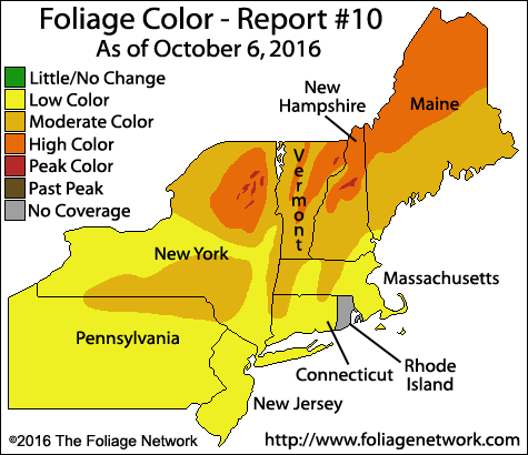
Image above courtesy of The Foliage Network. Follow them here!
Dry conditions may hurt color overall this season, but with nice days and cool evenings, I expect color to continue to expand nicely across the region in the next week. Take advantage of the weather and take a hike! For those in central Connecticut, Talcott Mountain State Park is a great park with easy trails.
The Dailies
Sunday: Rain tapering off by early afternoon, with clouds remaining. Breezy. Highs in the low to mid 60s, lows in the mid 30s to low 40s. Patchy frost possible.
Monday: Sunny and seasonably cool. Highs in the mid to upper 50s. Widespread frost and scattered freezes possible Monday night with lows in the low to mid 30s and isolated upper 20s.
Tuesday: Sunny and seasonably cool. Highs in the upper 50s to low 60s. Lows in the mid to upper 30s.
Wednesday: Sunny with highs in the low 60s.
Thursday: Sunny and warmer with highs in the mid to upper 60s. Slight chance of showers as the cold front passes. Chance of rain 10%.
Friday: Sunny and seasonably cool. Highs in the low to mid 50s. Nighttime lows in the 30s.
Saturday: Sunny with highs in the upper 50s to low 60s.
Finally, for those counting...
46 days to Thanksgiving
53 days to the start of meteorological winter
77 days to Christmas
84 days until New Years Day
Have a great week!
-DB
