
Good afternoon from Southern Connecticut Weather!
Happy last day of winter! Tomorrow at 6:29 AM spring officially begins. After a very active start to March, I am happy to report that finally, a quiet week is ahead! As a result, this will be a short discussion. The main topic of conversation will be the temperatures, which will be back and forth over the course of the week. Let’s get started.
Monday/Tuesday
The beginning of the week should feature warmer temperatures than we’ve seen most of the month. A warmer regime briefly works into the area in advance of our next arctic blast. We have to watch for the chance of showers late Monday night, but I think the odds are low. Overall, the first two days of the week look nice.

Wednesday/Thursday
Late Tuesday night, our next Arctic front moves through. As we move forward into spring, it is inevitable that these kinds of cold shots become less frequent and potent, but this one will have some bite. With 850mb temperatures more in line with what we’d see during the heart of winter, I expect surface temperatures well below normal and maybe approaching record territory. The wind will be brisk as well, and we’ll need to watch for snow showers or squalls as the front passes Wednesday.
Late Tuesday night, our next Arctic front moves through. As we move forward into spring, it is inevitable that these kinds of cold shots become less frequent and potent, but this one will have some bite. With 850mb temperatures more in line with what we’d see during the heart of winter, I expect surface temperatures well below normal and maybe approaching record territory. The wind will be brisk as well, and we’ll need to watch for snow showers or squalls as the front passes Wednesday.

Friday & the Weekend
By Friday, the Arctic air is departing and temperatures begin to slowly rebound. As the warm front approaches Friday, there could be rain showers associated with it, but right now I am keeping probabilities low.
By the weekend, we’re potentially watching another storm system approach the region, but right now, it is difficult (read: not really meaningful) to speculate on whether this will be a rain or wintry precipitation maker.
Finally, for those hoping for spring, the long term signals seem to be pointing to a period of warmer temperatures a week plus from now, as we potentially see a move toward greater ridging in the east. We had a false start to spring in February, but we will eventually see spring arrive in force. It is just a matter of time…
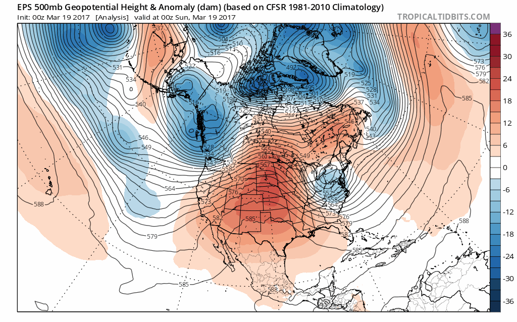
Above: EPS simulation of the next 10 days.
The dailies
Monday: Partly sunny and slightly warmer. Chance of showers late. Highs in the low to mid 40s. Chance of rain 10%.
Tuesday: Partly cloudy and warmer. Highs in the upper 40s to low 50s.
Wednesday: Sunny and cold with a slight chance of snow showers/squalls. Highs in the upper 20s to low 30s. Chance of snow 10%.
Thursday: Sunny and cold. Highs in the mid to upper 30s.
Friday: Partly cloudy and warmer with a chance of rain showers. Highs in the mid to upper 40s. Chance of rain 20%.
Saturday: Mostly sunny. Highs in the low to mid 50s.
Sunday: Partly cloudy. Highs in the mid to upper 30s. Chance of precipitation 40%.
Please like, share, and interact with us on our social media--on Facebook to share our discussions, and follow us on Twitter @southernctwx to retweet our posts! Hit the buttons below to join!
Have a great week!
-DB
