Good afternoon from SCW! There is a chance for thunderstorms tonight, with a possibility of damaging winds and hail across mostly northern Connecticut. Looking ahead, tomorrow looks like a similar story before we cool down for the weekend…
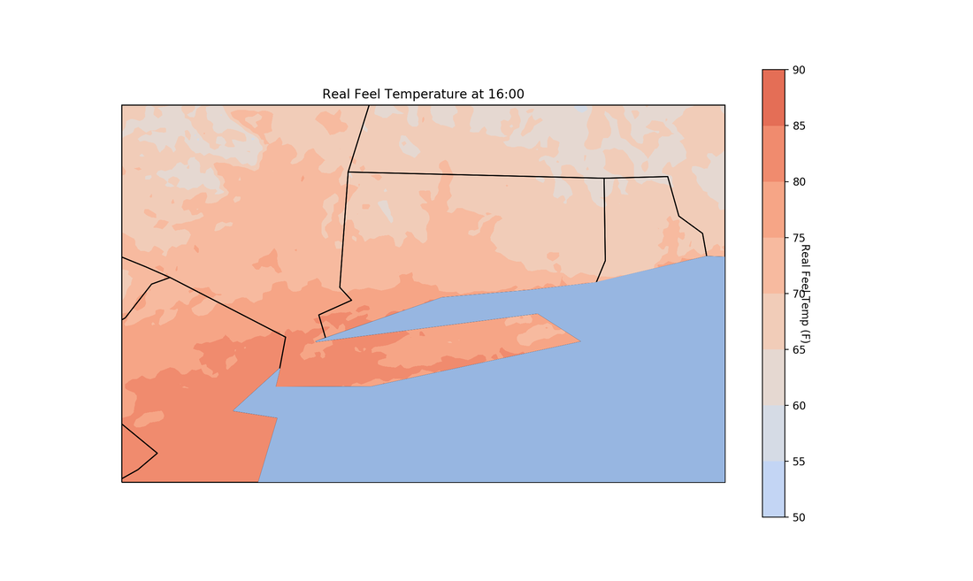
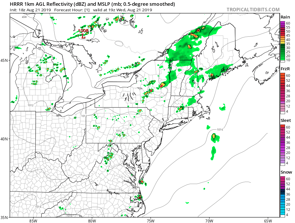
Currently temperatures are in the low-80s across the state, but oppressively high dew points are making it feel very muggy outside. The shoreline is staying slightly cooler from a sea breeze associated with the state-wide southerly flow. Spotty showers and thundershowers are moving through the state and will exit by late evening tonight as a result of a weak shortwave moving across the New England region. Now is where things get interesting…
Currently temperatures are in the low-80s across the state, but oppressively high dew points are making it feel very muggy outside. The shoreline is staying slightly cooler from a sea breeze associated with the state-wide southerly flow. Spotty showers and thundershowers are moving through the state and will exit by late evening tonight as a result of a weak shortwave moving across the New England region. Now is where things get interesting…
Tonight:
For tonight, relative humidity will remain high as temperatures drop. In addition, CAPE values will continue to climb to around the 2500-3000 mark, which is a good indicator of thunderstorm potential. And to add on to that helicity values and wind shear also are supportive of thunderstorms late tonight as well. In the upper atmosphere a 500 mb jet will swing across the great lakes, and if this jet moves closer to New England we could see some severe thunderstorms pop up across upstate New York, Massachusetts, and northern Connecticut. Now there are ingredients for thunderstorms, but another factor to take into account is the re-stabilization of the atmosphere as the sun sets, and the fuel for these systems starts to diminish. The timing for this event will be around midnight tonight, and the models tend to keep the heaviest of thunderstorms to the northern counties of CT for tonight, but I wouldn’t rule out a thunderstorm or two developing across the rest of the state.
For tonight, relative humidity will remain high as temperatures drop. In addition, CAPE values will continue to climb to around the 2500-3000 mark, which is a good indicator of thunderstorm potential. And to add on to that helicity values and wind shear also are supportive of thunderstorms late tonight as well. In the upper atmosphere a 500 mb jet will swing across the great lakes, and if this jet moves closer to New England we could see some severe thunderstorms pop up across upstate New York, Massachusetts, and northern Connecticut. Now there are ingredients for thunderstorms, but another factor to take into account is the re-stabilization of the atmosphere as the sun sets, and the fuel for these systems starts to diminish. The timing for this event will be around midnight tonight, and the models tend to keep the heaviest of thunderstorms to the northern counties of CT for tonight, but I wouldn’t rule out a thunderstorm or two developing across the rest of the state.
Tomorrow:
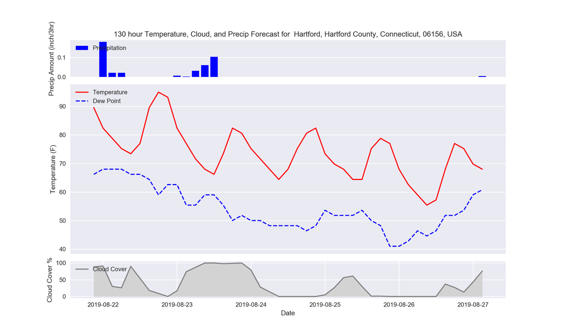
Tomorrow humidity and temps will be slightly worse than today, with a possible peak of sunshine in the afternoon before clouds build in for the evening again. Tomorrow night into Friday morning we run the risk of thunderstorms as a cold front approaches, and instabilities similar to today remain in the region. Highs for tomorrow will be in the mid 80s, or locally higher if the sun can stay out long enough.
This Weekend:
Friday temperatures take a plummet and humidity will drop off with the institution of a northerly flow from an associated high pressure system. Temperatures may not even break the 80s for Friday, Saturday, and even Sunday as high pressure will keep us cooler and dry. That is good news for any festivals/fairs going on this weekend as we head towards the end tail of summertime. The start of next week will continue this dry pattern until midweek, where we may see some wet weather and a return to warmer temperatures for the second part of next week.
Here is the GFS forecast for inland Connecticut through Monday next week.
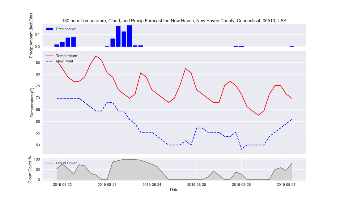
Here is the GFS forecast for the shoreline of Connecticut through Monday next week.
The Dailies
Thursday: Oppressive. Highs in the upper-80s with very humid weather. Chance for thunderstorms late.
Friday: Improving conditions with sunnier skies and milder conditions. Highs in the 70s with a slight wind from the north.
Saturday: Sunny and mild. Highs in the upper 70s.
Sunday: Mostly sunny and mild. Highs in the upper 70s.
Monday: Chance for a shower. Highs in the upper 70s.
Tuesday: Cloudier with highs in the 70s.
Wednesday: Chance for a shower, otherwise cloudy and warmer with highs around 80.
Thank you for reading SCW!
-LD
