Good morning to you from Southern Connecticut Weather!
A beautiful weekend is in the forecast before things get a bit messier next week as yet another storm cuts to our west. Once again, with out a strong high pressure or blocking in place, this storm will be another mixed precipitation event, eventually sending the state into the warm sector before cooler air returns later next week.
Saturday-Monday
Seasonably cool conditions will persist for the weekend as we finally(albeit temporarily) move back into a winter like pattern. Aside from some isolated flurries Sunday evening, the short term looks dry, with temperatures slightly below normal today, slightly above normal tomorrow, and near normal on Monday. Any low level clouds today will burn off this morning, but a thicker deck moves in tonight and lasts into Monday before a bit of sunshine returns. Overall, a quiet and seasonable weekend, and with the recent snowfall to our north, it should be a great weekend for winter sports lovers to get out on the slopes (I can confirm firsthand that Vermont is skiing amazingly right now) or on the trails of northern New England!
Tuesday-Wednesday
If it seems like we’ve seen this story several times before this winter, you wouldn’t be wrong. Once again, we will see low pressure move out of the plains and, with no blocking to push it east and out to sea/up the coastline, it will cut to our west and bring a surge of warm air into the state. As we’ve seen with all of the prior events, the eventual track of the storm will depend on the strength and placement of high pressure to our north. Previous model runs kept the high further southwest over New England, forcing the storm to weaken and then redevelop under or east of us. That outcome would be a wintry one for many, with an initial thump of snow likely transitioning to more of an icy mix. Over the past several model cycles, the trend has been to weaken the high and allow the storm to come further north before transferring, resulting in the state making it into the warm sector and seeing temps spike well above normal after some initial light snows.

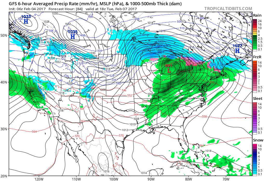
To show the trend, here’s a look at the GFS from Friday morning vs. the GFS from this morning. Notice the high placement – this morning it is much further east than where it was being modeled yesterday, resulting in the storm cutting further to our west and allowing warm air to move in earlier. For now, I am heavily leaning towards the warmer solution as there is a strong model consensus for that to occur, but at the same time, I’m not entirely closing the door on the high trending stronger as we get closer, which often occurs in these sorts of situations. We would need to see fairly large-scale changes to have a shot at significant wintry weather, but hey, stranger things have happened. Will carry likely pops Tuesday-Wednesday, starting as rain or wintry mix on Tuesday and all rain on Wednesday.
Thursday-Friday
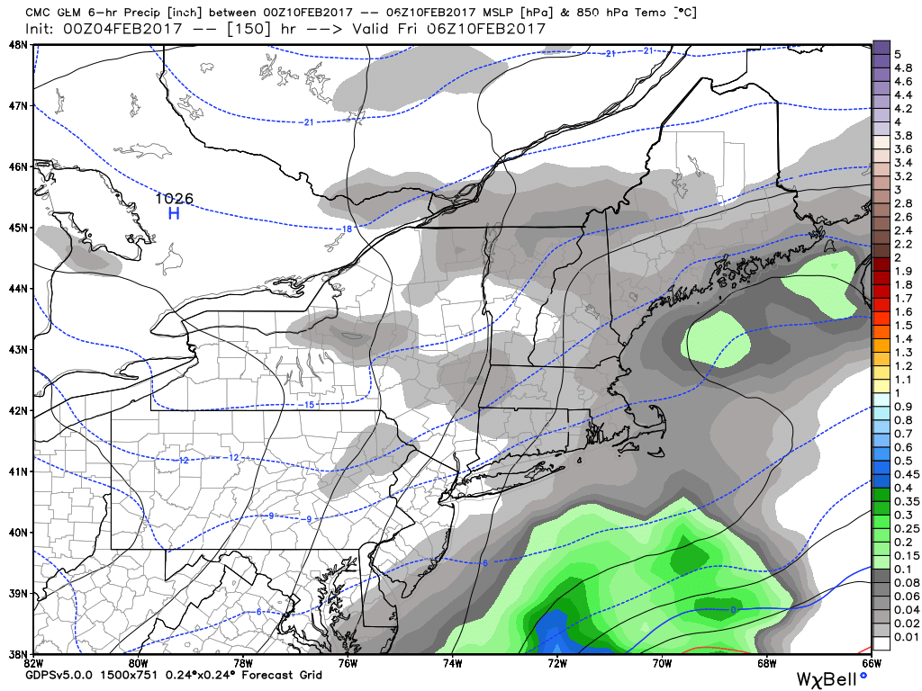
Behind the storm, cooler air moves in. Right now, it looks like a followup coastal will develop well out to sea and miss our area, but at this lead time, we could see a trend west (that some guidance has hinted at off and on), so will not rule out some snow during this period. For now though consensus is a dry and cold forecast.
Here's the GGEM for this system - the closest model to the coast. As you can see, it only has some light snow showers in the area, but heavier precipitation lurks not that far offshore. Longshot, but worth keeping an eye on.
Thursday-Friday
Behind the storm, cooler air moves in. Right now, it looks like a followup coastal will develop well out to sea and miss our area, but at this lead time, we could see a trend west (that some guidance has hinted at off and on), so will not rule out some snow during this period. For now though consensus is a dry and cold forecast.
Here's the GGEM for this system - the closest model to the coast. As you can see, it only has some light snow showers in the area, but heavier precipitation lurks not that far offshore. Longshot, but worth keeping an eye on.
The Dailies
Saturday: Mostly sunny, with highs in the upper 20s to lower 30s.
Sunday: Mostly cloudy, with highs in the mid to upper 30s.
Monday: Partly sunny, with highs in the low to mid 30s.
Tuesday: A chance of snow, sleet and freezing rain early, then rain and wintry mix likely. Highs in the mid to upper 40s. Chance of precipitation is 70%.
Wednesday: Rain likely. Highs in the low to mid 50s. Chance of precipitation is 80%.
Thursday: A slight chance of snow showers, otherwise, partly sunny, with highs in the upper 20s to lower 30s.
Friday: Mostly sunny, with highs in the low 30s.
Have a wonderful weekend and thank you for reading SCW!
-SA
