A cold front swings through the area this evening, bringing temperatures back to normal or below levels for tomorrow. A chance of showers will sneak into the forecast towards the end of the day, but overall, it looks to be a dry day, with a mix of sun and clouds expected along with temperatures in the mid 60s.
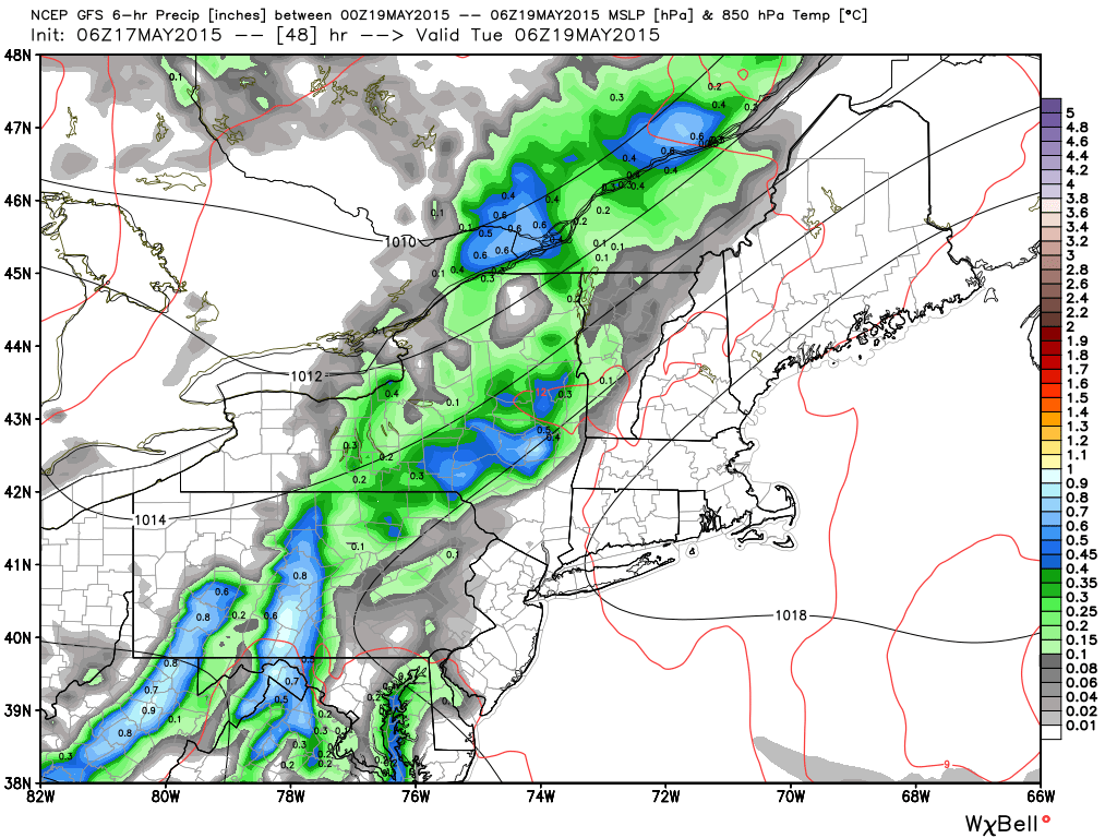
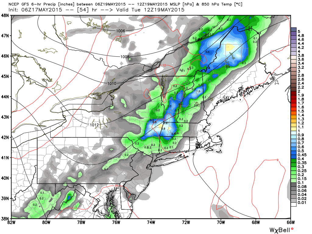
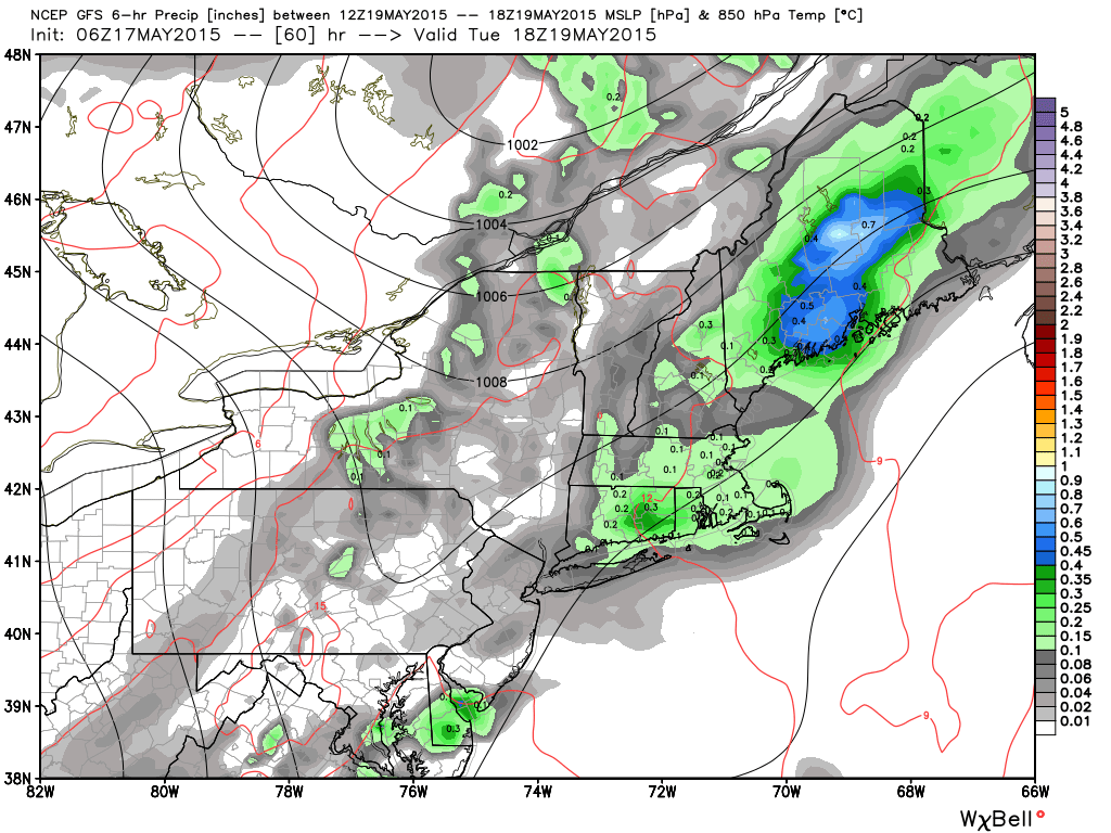
A line of showers rolls in from the NW Monday evening, and will result in a wet Tuesday, with mainly light rain expected across the area, although a few areas of moderate or heavy rain could be embedded in the line. As of now, I’m not expecting any severe weather to come as a result of this line of showers, although some thunderstorms are likely Tuesday afternoon. Temperatures will be a bit warmer than Monday, with highs around the normal mark in the upper 60s to lower 70s. In general, it looks like rainfall amounts will be a couple tenths of an inch across most of the state, but some areas that get into the area of moderate rain or are under developing convection could see quite a bit more, with amounts of an inch or so not out of the question in any thunderstorms that do develop.
A line of showers rolls in from the NW Monday evening, and will result in a wet Tuesday, with mainly light rain expected across the area, although a few areas of moderate or heavy rain could be embedded in the line. As of now, I’m not expecting any severe weather to come as a result of this line of showers, although some thunderstorms are likely Tuesday afternoon. Temperatures will be a bit warmer than Monday, with highs around the normal mark in the upper 60s to lower 70s. In general, it looks like rainfall amounts will be a couple tenths of an inch across most of the state, but some areas that get into the area of moderate rain or are under developing convection could see quite a bit more, with amounts of an inch or so not out of the question in any thunderstorms that do develop.
Good Sunday morning to you from Southern Connecticut Weather!
We finally got some rain yesterday, providing a bit of much needed relief, and thankfully, while we don’t have any huge storms in the forecast, we do have some more chances at getting some of the wet stuff into the state in the next few days.
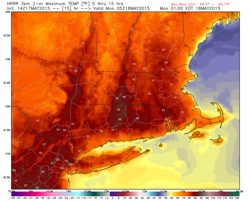
For today, we’ll have another summer-like day, with high temperatures in the lower 80s, and partly sunny skies. Today will be the warmest day of the forecast period, so if you’re looking for a taste of summer, make sure to get out there this afternoon and enjoy the warmth!
We finally got some rain yesterday, providing a bit of much needed relief, and thankfully, while we don’t have any huge storms in the forecast, we do have some more chances at getting some of the wet stuff into the state in the next few days.
For today, we’ll have another summer-like day, with high temperatures in the lower 80s, and partly sunny skies. Today will be the warmest day of the forecast period, so if you’re looking for a taste of summer, make sure to get out there this afternoon and enjoy the warmth!
Showers exit to our southeast and bring another nice day for Wednesday, with temperatures in the upper 60s along with mostly sunny skies expected. Sunny skies and moderate temperatures (Highs generally in the low 70s) continue through next weekend before a potential storm system approaches for the beginning of next week.
Thank you for reading SCW!
-SA
Thank you for reading SCW!
-SA
