A very good morning to you from Southern Connecticut Weather!
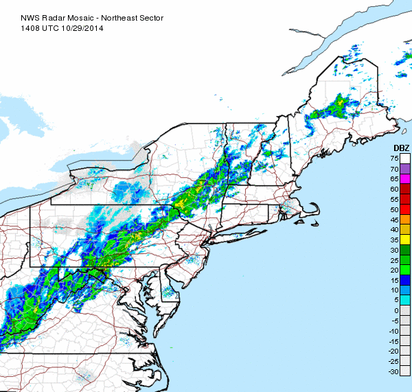
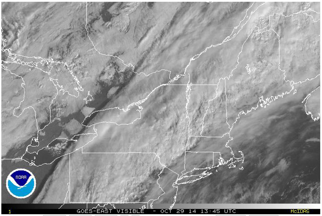
Currently looking at partly to mostly cloudy skies across the state, which should continue to fill in with clouds over the course of the morning as the front that you can see on the visible satellite continues to move SE towards the state. As you can see on the radar, there's some light to moderate showers accompanying that front, which look to impact us later in the day today. Precipitation totals look to be limited to a tenth of an inch or two, but some brief periods of moderate to heavy rain are possible which could provide some locally higher amounts. Generally though, no big deal with just light rains expected. Highs today similar to yesterday in the upper 60s to lower 70s.
Currently looking at partly to mostly cloudy skies across the state, which should continue to fill in with clouds over the course of the morning as the front that you can see on the visible satellite continues to move SE towards the state. As you can see on the radar, there's some light to moderate showers accompanying that front, which look to impact us later in the day today. Precipitation totals look to be limited to a tenth of an inch or two, but some brief periods of moderate to heavy rain are possible which could provide some locally higher amounts. Generally though, no big deal with just light rains expected. Highs today similar to yesterday in the upper 60s to lower 70s.
Cold front comes through on the back end of the clouds and showers tonight and leads to much lower temperatures for the end of the week. Sunny skies expected for tomorrow and Friday, with highs in the mid to upper 50s both days.
You've probably been hearing a lot of talk from some outlets about a storm system which could impact us this weekend in that it could bring some snow to the area. While earlier model runs showed this as a fairly significant snowstorm for parts of the area, model consensus seems to be growing on an event that for the most part misses us to our east, leaving only lighter precipitation around, mainly in the form of rain. Previous model runs had a single, consolidated piece of energy, allowing the storm to come up the coast, but the newer runs now dig that energy further south into the US and send it around the trough to come back north later, so by the time it's captured and can develop into a significant storm, it's gone too far to the east to impact us. Some models also show the energy splitting into a double low, which wouldn't provide the dynamics needed to bring it closer to the coastline.
There is one exception to this, however, and that is the ensemble mean of the EURO model, which keeps the energy strong and close to the coast. As a result, heavier precipitation would work it's way into at least eastern sections, allowing for stronger dynamics to cool the atmosphere and perhaps flip some areas over to snow towards the end of the event. As of now, this is a low probability scenario, but it is worth noting that the last few runs of the other models have been trending further west.
We'll continue to keep an eye on modeling and will update if anything changes, but for now, it looks like we're looking at a chance of showers for Saturday and Sunday, perhaps mixing with or changing over to snow towards the end of the event, although minimal at best accumulations are expected. Temps look to be well below normal throughout, in the mid to upper 40s on Saturday and in the low to mid 40s on Sunday, lows Saturday night getting down into the upper 30s. Strong winds, although not to the level we saw with last weeks storm, are also a decent possibility. Heaviest precipitation amounts will be to the eastern parts of the state, with western areas seeing lesser amounts or, unlikely but possible, nothing at all. We'll continue to keep an eye on the models, and if they start to shift back to the snowier solution, you'll be the first to know.
Much colder air comes in in the wake of the storm, with highs on Monday not getting out of the 30s likely, and a freeze is likely Sunday night. Gradual warming trend commences after that towards midweek, although temps still look to be at or below normal.
Look for another update tonight or tomorrow, until then, have a wonderful day!
-SA
