Good morning to you from Southern Connecticut Weather!
As promised, we saw some snow across the state this morning, with accumulations ranging from a coating on the shoreline to several inches further inland, with jackpot values around 5” in the hills north and east of Hartford. We’ll do a complete verification map once the system wraps up and we have a final totals report, but for the most part, it looks like our forecast will verify well for part one of our return to winter.
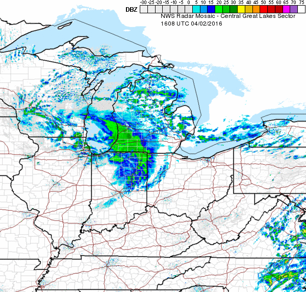
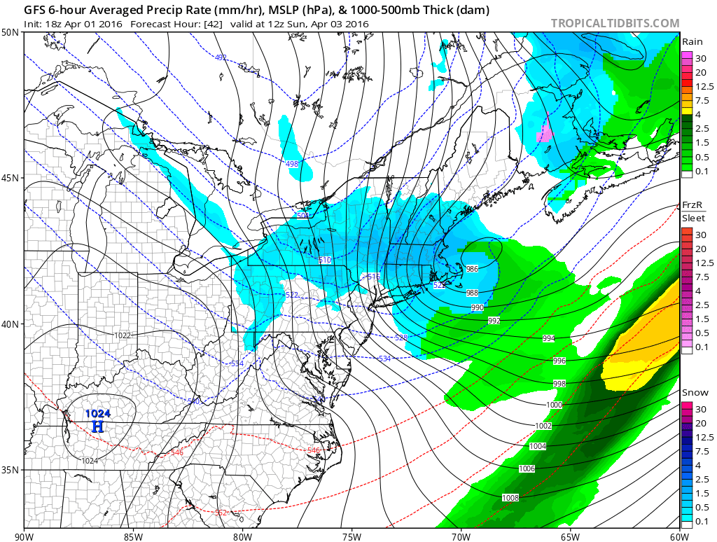
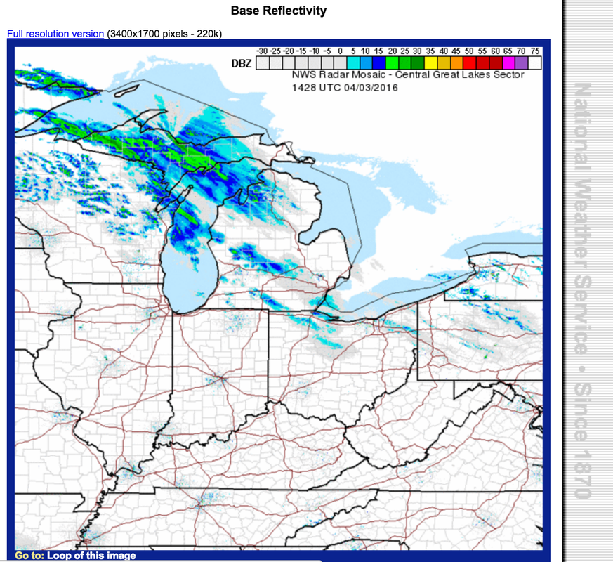
We now turn our attention to part two of our tale of two snowstorms as another clipper system approaches the state from the Midwest tomorrow morning. Here’s a look at it on radar
As promised, we saw some snow across the state this morning, with accumulations ranging from a coating on the shoreline to several inches further inland, with jackpot values around 5” in the hills north and east of Hartford. We’ll do a complete verification map once the system wraps up and we have a final totals report, but for the most part, it looks like our forecast will verify well for part one of our return to winter.
We now turn our attention to part two of our tale of two snowstorms as another clipper system approaches the state from the Midwest tomorrow morning. Here’s a look at it on radar
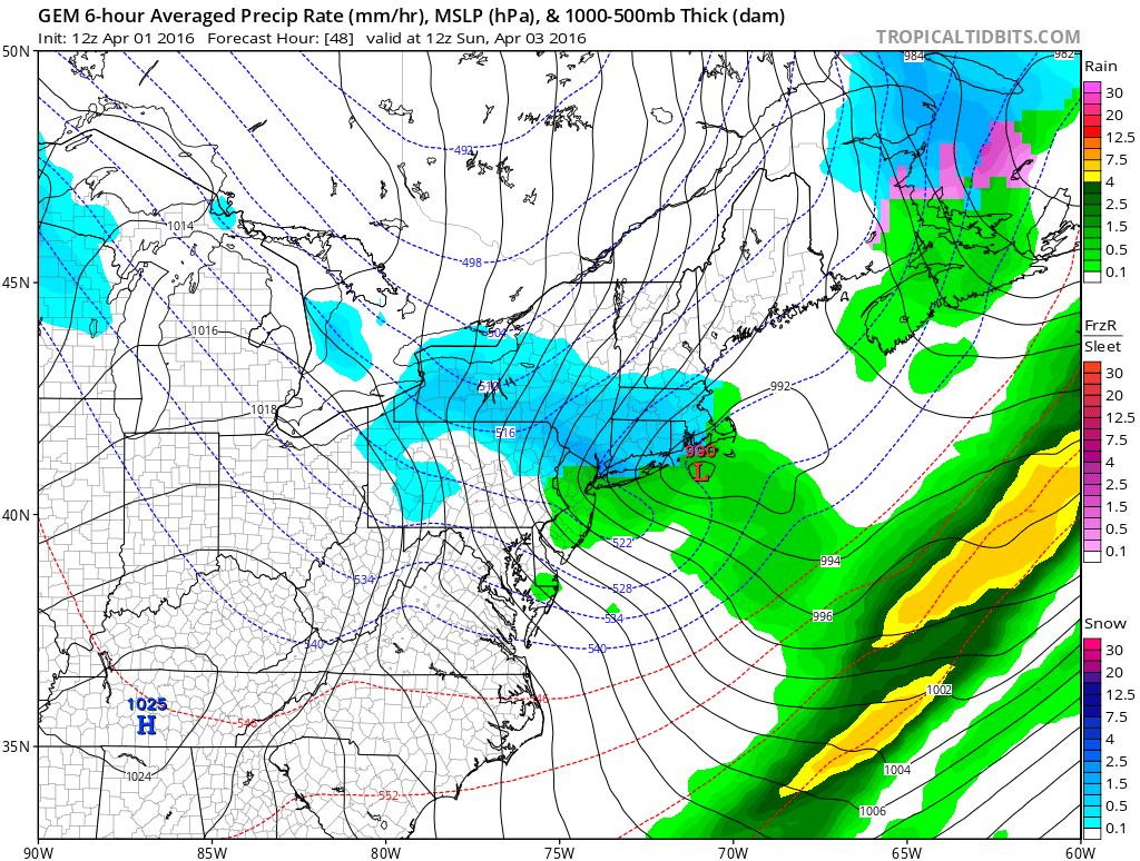
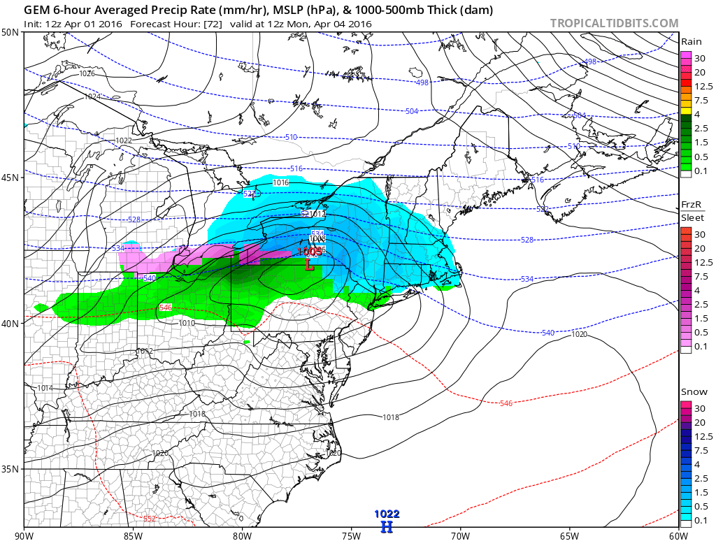
This one, unlike today’s supercharged shortwave, will be more of your classic clipper system, with a fairly widespread precipitation shield of light to moderate intensity. Model confidence is pretty high for this one, with general agreement of around a half an inch of liquid equivalent falling across the state. The main question that we have to answer is when and where we will see a changeover to rain, and if we see a changeover back to snow on the back end of the system.
Snow moves in tomorrow morning, breaking out before sunrise across most of the state. Initially, I expect everywhere to start as snow, but by mid-morning, I expect coastal areas to change over to rain, and the rain snow line should move steadily north throughout the morning into the early afternoon. As the system begins to move to our east, colder air will funnel in behind the storm, possibly flipping some areas back to snow for a time as the storm departs. Precipitation should taper off from northwest to southeast from the late afternoon through the evening hours, with all snow out of the state by midnight at the latest.
As far as where the rain/snow line ends up, the guidance looks to be in pretty good agreement that the northern limit will be around the MA/CT border, with most models keeping northern CT as all or mostly snow. As such, considering that we’re looking at a well-defined consensus of about a half inch of liquid, I’m comfortable with an advisory level snowfall in that area.
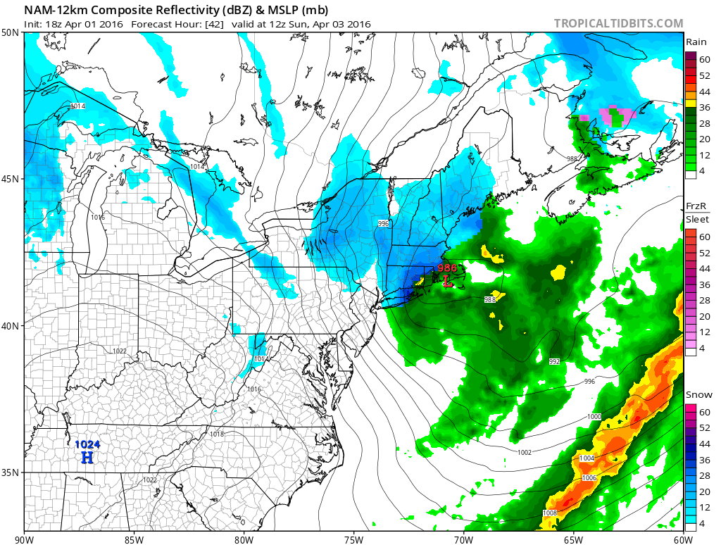
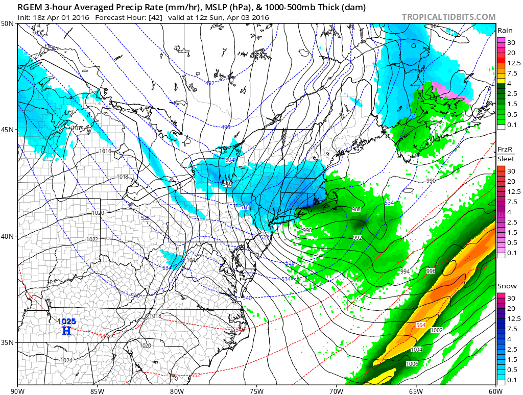
Further south remains somewhat unclear. As mentioned before, guidance is in good agreement that the northern border is about the furthest north the line could get, but some modeling, specifically the NAM and it’s high resolution cousin, keep it much further south, and allow most of the state away from the shoreline to remain all snow.
Here’s a look at the temperatures on the highres NAM and the GFS for tomorrow at 2 PM.
Snow moves in tomorrow morning, breaking out before sunrise across most of the state. Initially, I expect everywhere to start as snow, but by mid-morning, I expect coastal areas to change over to rain, and the rain snow line should move steadily north throughout the morning into the early afternoon. As the system begins to move to our east, colder air will funnel in behind the storm, possibly flipping some areas back to snow for a time as the storm departs. Precipitation should taper off from northwest to southeast from the late afternoon through the evening hours, with all snow out of the state by midnight at the latest.
As far as where the rain/snow line ends up, the guidance looks to be in pretty good agreement that the northern limit will be around the MA/CT border, with most models keeping northern CT as all or mostly snow. As such, considering that we’re looking at a well-defined consensus of about a half inch of liquid, I’m comfortable with an advisory level snowfall in that area.
Further south remains somewhat unclear. As mentioned before, guidance is in good agreement that the northern border is about the furthest north the line could get, but some modeling, specifically the NAM and it’s high resolution cousin, keep it much further south, and allow most of the state away from the shoreline to remain all snow.
Here’s a look at the temperatures on the highres NAM and the GFS for tomorrow at 2 PM.
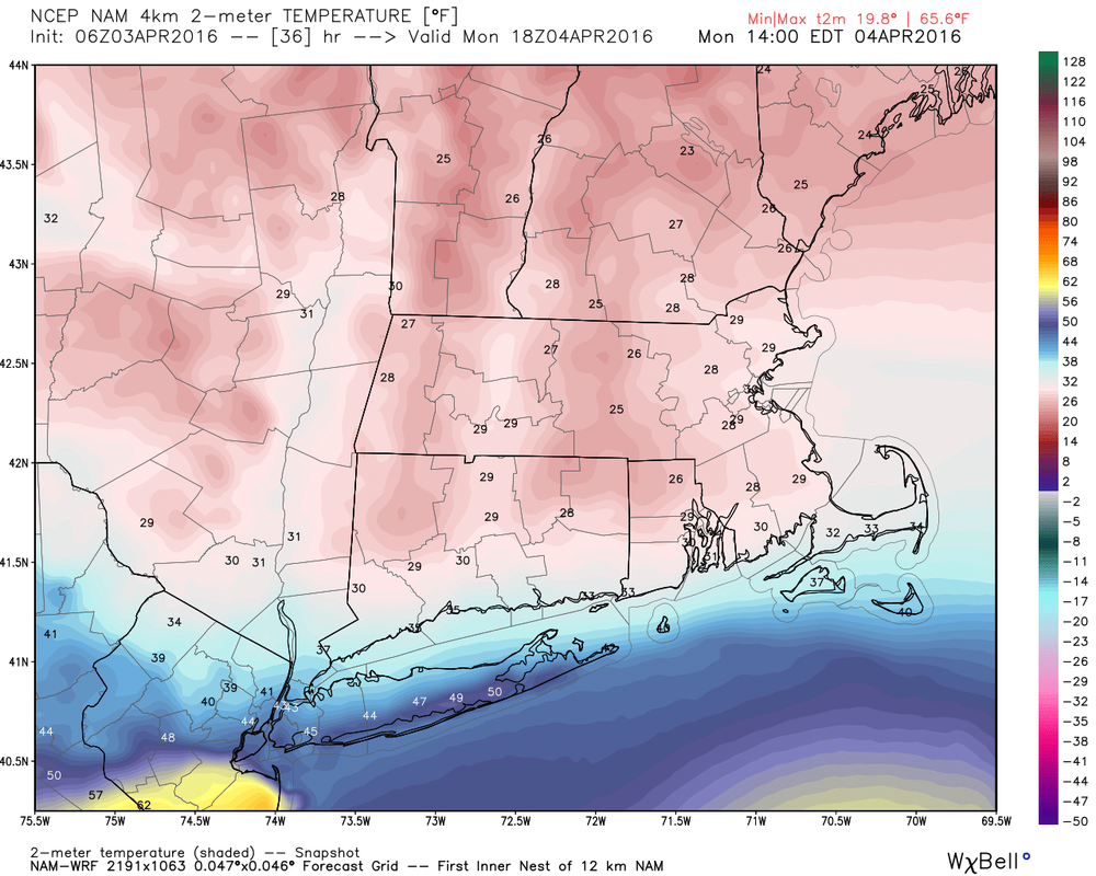
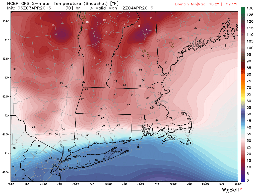
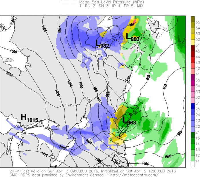
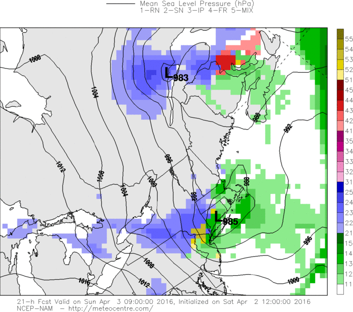
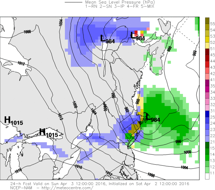
Comparing these images shows that on the GFS, the warm front to the south of the system is allowed to come further north onto the shoreline, and as a result push up the 32 line into the northern part of the state, due to the track of the system being slightly north of where the highres NAM places it. This is shown well on the surface plots below (Look at where the center of the circle of the lowest pressure is place, represented by the black circular lines)).


The question then becomes which one do we believe? As of now, I’m inclined to lean towards a view that’s closer to the GFS than the NAM, for a couple of reasons. First, as wintry as it may seem right now with a snowstorm today and another on the way, it’s still April, and the April sun angle, combined with wet ground from the melting of todays snow, could limit accumulations unless heavier rates develop that can overpower that combination. As of now, I don’t see prolonged heavier snow from this system, and as a result I’m inclined to lean a bit more conservatively on the forecast totals. Furthermore, while the GFS is often warmth-happy on the surface, I don’t really see a mechanism to keep the shoreline from warming, and whether it’s 34 or 44 still means the same thing for snow totals ;) Finally, while I do have some concerns about the middle of the state verifying colder than expected, I just don’t see the dynamics with this system that will allow the cold air to hold, and as such, I think that ultimately, all but the far northern tier do eventually turn over to rain.
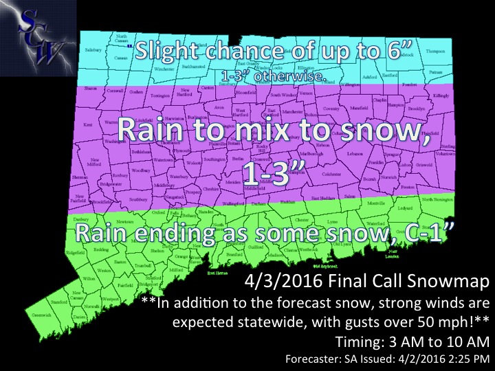
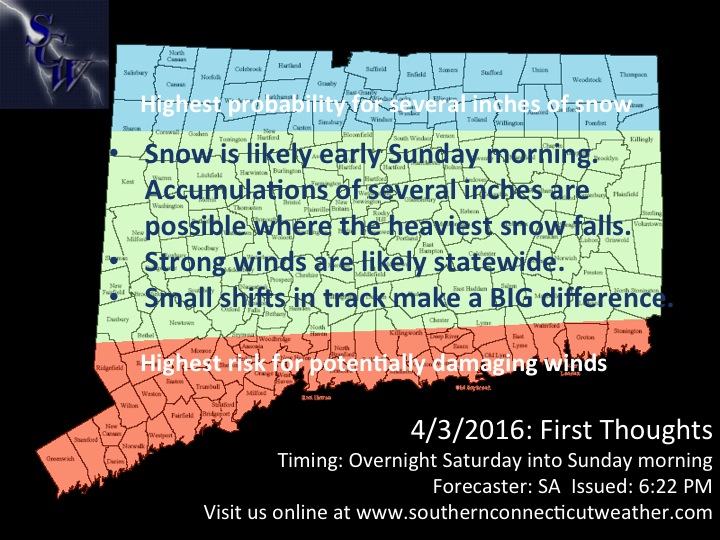
However, that doesn’t mean that sections further south won’t see snow. Here’s our forecast snowmap for this event.
However, that doesn’t mean that sections further south won’t see snow. Here’s our forecast snowmap for this event.
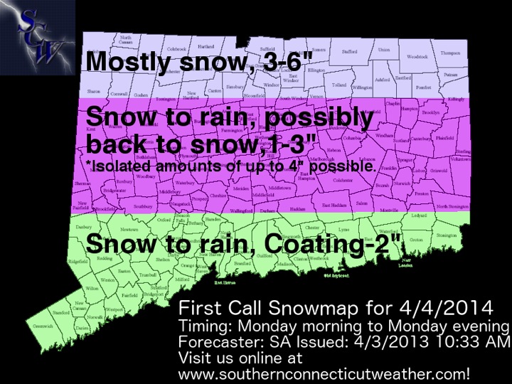
As we mentioned earlier, the northern tier will stay all or mostly snow for this event, and as such, an advisory level snowfall is expected, with three to six inches of snow forecast. Along the shoreline, after a brief period of snow in the morning, snow should change over to rain by mid-morning, and as such only a coating to two inches of snow is forecast. For the rest of the state, while snow will last longer into the morning, by early afternoon, the rain/snow line will have pushed through most of the state. By later in the afternoon, however, as cold air begins to push south and east into the state, precipitation will begin to flip back to snow from north to south, and an additional light accumulation of up to an inch or so is possible. Combining the snow from the morning and any possible backend snows, I’m expecting one to three inches of snow for the middle of the state, with a period of rain in the middle, although I do think we will see some isolated amounts of up to four inches. If we see a changeover on the back end back to snow, or if we see a delayed changeover on the front end, those three to four inch readings will be more widespread, but I’m not confident in the whole zone seeing at least 2” and 1-4” is too large a range for such a small amount overall.
Timing:
-SA
Timing:
- 3 AM – 8 AM: Snow breaks out west to east, light at first but then becoming steadier as the morning commute progresses.
- 8 AM – 10 AM: The shoreline begins to change over to rain, steadier snow continues in the remainder of the state.
- 10 AM – 1 PM: Snow changes over to rain from south to north, with the northern tier of the state remaining all snow.
- 1 PM – 3 PM: If the northern tier does change to rain, now is the time, otherwise, rain continues for most of the state with snow in the northern tier.
- 3 PM – 6 PM: The rain-snow line begins to push south, flipping some areas back to snow. Rain continues further south.
- 6 PM – 10 PM: Snow tapers off northwest to southeast, with a possible flip back to snow shortly before the end of the precipitation statewide.
-SA