We're back into cool weather for a while... going forward into the long range, it doesn't look like any super exciting pattern either way, with regards to normals. In other words, a typical spring pattern, with very warm days and very cool days mixed in, with near normal rainfall.
Currently: An interesting frontal system extends all the way from near the Grand Canyon to Quebec City. A small cold air wedge extended from Quebec down the Alleghenies into Virginia. This has kept the area cool today.
Tonight: The warm"er" air will make a push at the area, and this will spread rain into the area. Rain should spread across the state, and rain, mostly light, will fall on and off for about 12 hours or so. Temperatures probably only fall another degree or two, before leveling off. Expect low temperatures in the mid to upper 40s.
Tomorrow: As long as the rain pulls out when expected, it should allow for a decent rest of the day, with highs in the mid 60s.
For tomorrow night and Friday: As I frequently rant, the warm frontal passage will not make it through the state like most models were showing 24 hours ago. Therefore, temperatures should probably stay i the mid 50s, which is significantly colder than what was predicted. As the warm front tries to approach, but never makes it to the area, some precipitation will spread up along the boundary. With the colder temperatures also comes a change of the forecast character of the precipitation. Instead of calling for showers and isolated thunderstorms, it seems more of a light rain/drizzle type forecast, with precipitation lingering for most of the day.
Long Term- The weekend and beyond: Saturday is definitely the better of the two days of the weekend. A ridge will briefly build in and dry us out between the two systems. Highs on Saturday should be in the 60-65 degree range.
For Sunday, a storm will ride up the coast and produce a truly gloomy period, with steady rain and chilly temperatures. There is some question as to how far north the storm will make it, and as a result, how far north the precipitation will make it. Some models fringe the state. For now, given the time of year, combined with continuity and typical model biases, I'll go further north than model consensus, and bring light to moderate, steady rainfall into the state. High temperatures on Sunday should only be in the low 50s.
The rest of next week looks nice with temperatures mostly at or a bit below normal, but trending upwards the rest of the week. There are no significant precipitation threats for quite a while into the long term.
In the long range, the general outlook looks to feature a lot of ups and downs. Some very warm days and some quite chilly days are all possible. Precipitation also looks quite normal in the long range, with frequent enough frontal passages providing rain chances.
Now, let's take a look at some of the systems slated to affect the area this week in graphical format. First, here's Friday's system.
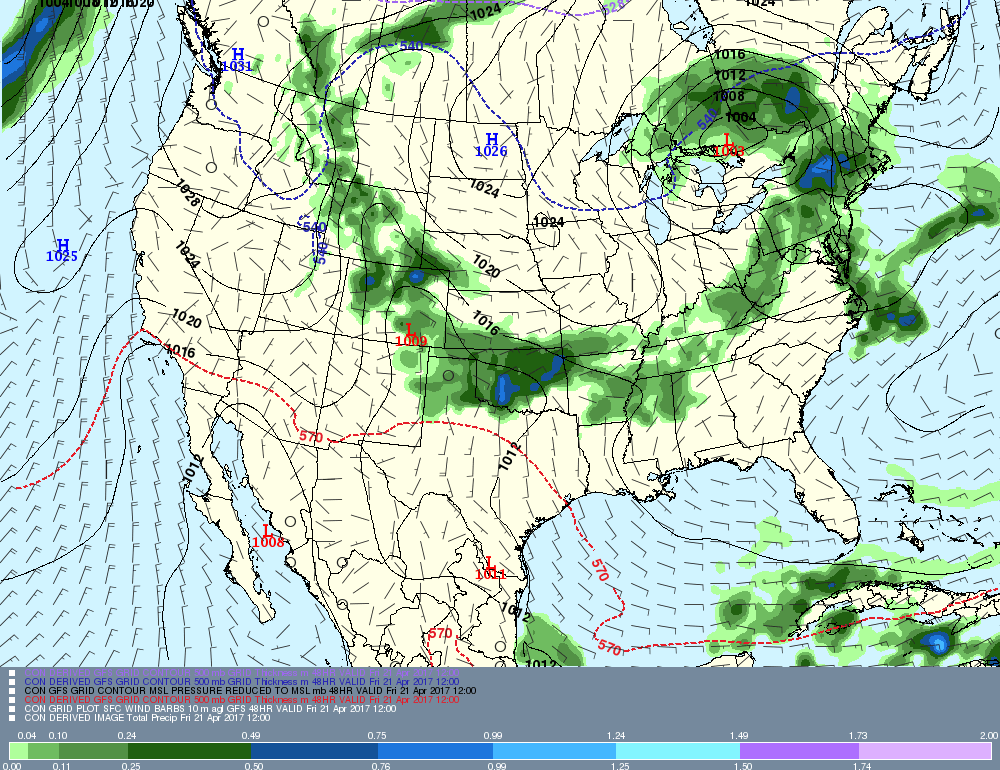
Although the heaviest precipitation on this map is north and west of the state, over upstate NY and the Berkshires, the state still receives a day of light rain and drizzle on this map.
Now, let's look at the system slated for Sunday, the coastal storm.
Now, let's look at the system slated for Sunday, the coastal storm.
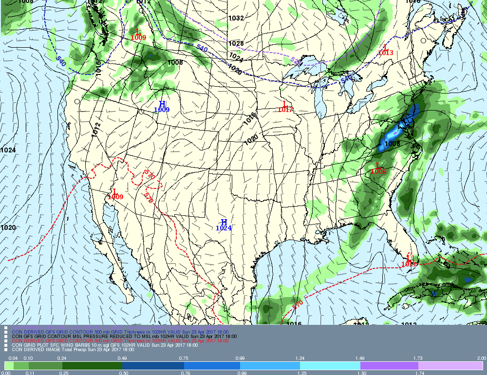
On this map, the storm is shunted to our south. However, this model and models in general tend to have a bias of shunting things too far to the south at this range. Therefore, I will bring the rain further north than what this map shows.
Anyway, that's all for now... have a great rest of your week!
-GP!
Anyway, that's all for now... have a great rest of your week!
-GP!
