Good evening and happy meteorological spring from SCW!
Finally, we turn the page to March. Today is the start of meteorological spring, which encompasses March, April, and May. Summer will be here before you know it!
For winter lovers, there's not much good that can be said about February, or much of meteorological winter. What is historically our snowiest month, February, ended up being warm and virtually snowless.
Well, the first week of March is looking--surprise--warmer than normal. It will likely be unsettled with rain chances during the week. By the end of the week, we will be watching another storm that may bring wintry precipitation chances. Let's look at the week ahead.
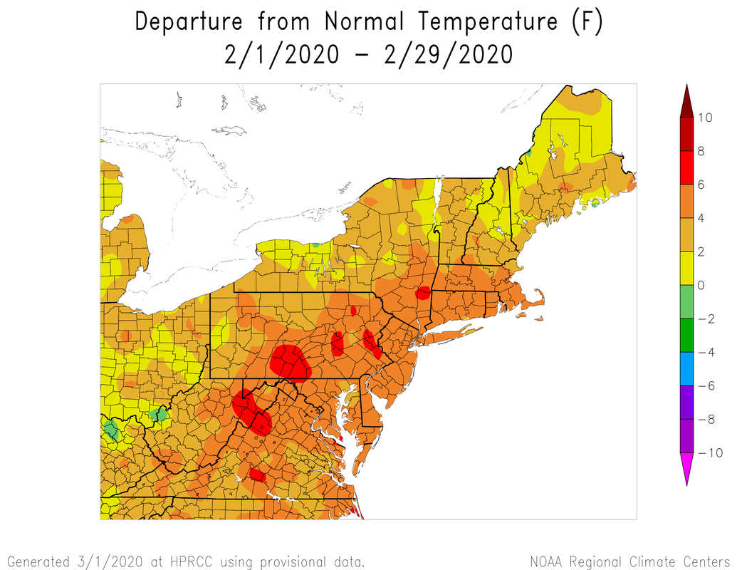
Just like January, February was...warm. We've seen the Atlantic pattern historically hostile and consistent for any real prolonged periods of winter.
Monday
Tomorrow looks pretty good! After a chilly weekend, we should warm up quite a bit tomorrow. High pressure will remain in place, but its placement will allow for more clouds early in advance of a warm front. No precipitation is expected during the day or evening, but it will be a bit breezy.
Tuesday-Wednesday
A system will pass through the region on Tuesday, bringing rain showers. This may happen in two bouts, the first during early morning hours, and the second during the evening and overnight hours. This doesn't look like a significant rain event.
The rain showers should continue into early Wednesday. Right now, I think that things will begin clearing out during the morning hours, but clouds may linger through the day. We should see breezy conditions once more, but nothing particularly significant.
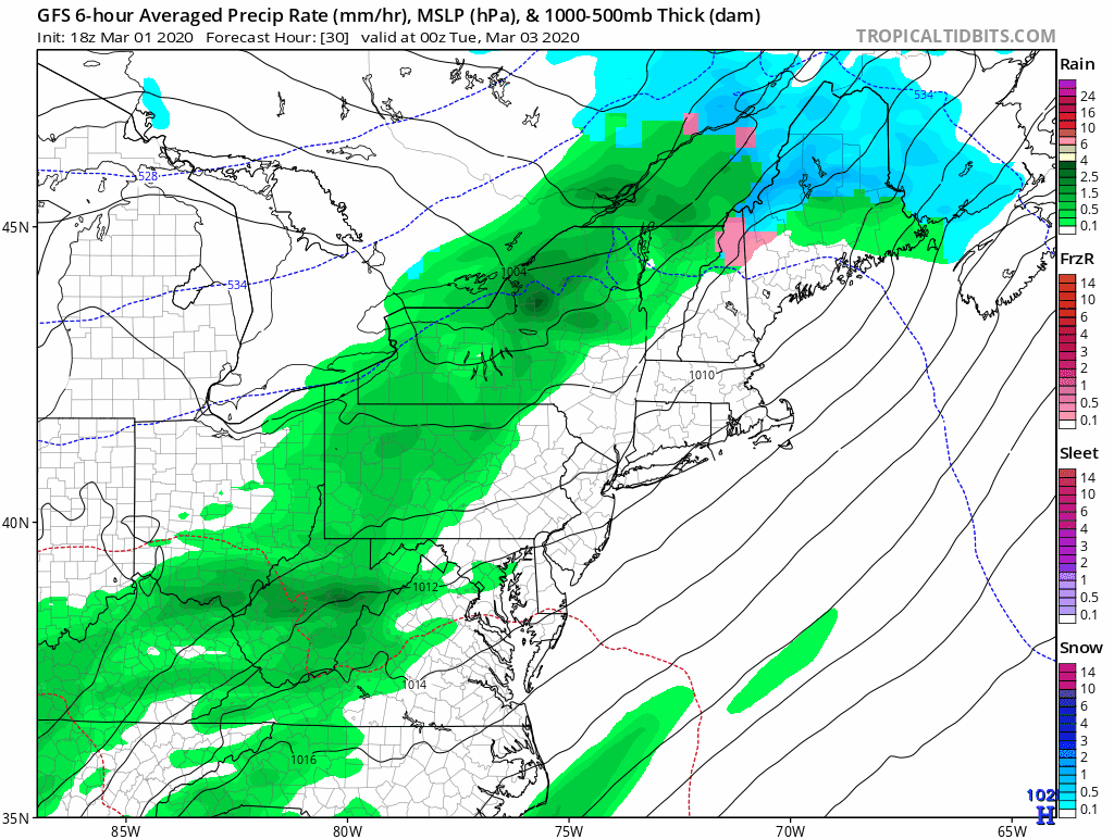
GFS depiction of the first unsettled period Tuesday and Wednesday. It looks wet, but not terribly significant.
Thursday-Friday
Thursday looks good. The storm system will clear, and will bring us clearing conditions during the day. Temperatures will be fairly warm for this time of year as well.
However, by Friday we're likely watching two separate pieces of energy approach the region. There is a signal that a significant storm could develop, but as we have seen all winter, there is a lot that could go wrong. There's not much to say right now, other than Friday currently looks ok. By the middle of the week we'll have a better sense of whether these separate pieces of energy will "phase". If that happens, a significant event becomes more possible. I'm introducing low odds for now.
Saturday-Sunday
If we end up with a storm, I think the bulk of it would happen on Saturday, though an earlier start is still possible. If there is no storm, the weekend looks great with colder temperatures and clear skies.
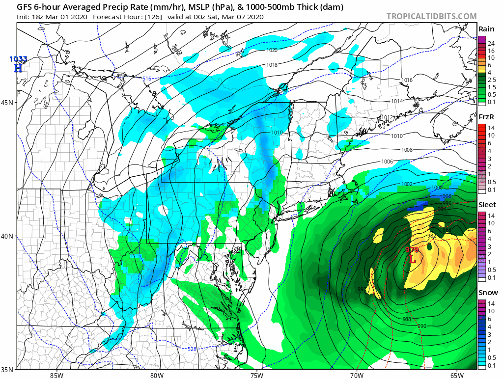
GFS depiction of a near miss on Saturday. We should clear out one way or another by Sunday.
The Dailies
Monday: Partly sunny and warmer with breezy conditions. Highs in the low to mid 50s.
Tuesday: Mostly cloudy with a chance of rain showers. Highs in the upper 50s to low 60s. Chance of rain 50%.
Wednesday: Mostly cloudy early with morning showers, followed by gradual clearing and breezy conditions. Highs in the low to mid 50s. Chance of rain 30%.
Thursday: Partly sunny and breezy. Highs in the upper 40s to low 50s.
Friday: Increasing clouds with a chance of rain or snow late. Highs in the low to mid 40s. Chance of precipitation 20%.
Saturday: Mostly cloudy with a chance of snow. Highs in the mid 30s. Chance of snow 20%.
Sunday: Mostly sunny and breezy. Highs in the upper 30s to low 40s.
As always, please like, share, and interact with us on our social media--on Facebook to share our discussions, and follow us on Twitter @southernctwx to retweet our posts. Hit the buttons below to join.
Thank you for reading SCW.
-DB
