Good evening from Southern Connecticut Weather.
No rest for the forecasters at SCW, as we open the book on a wintry week right after our snow event yesterday. Looking at snow totals around the state, we did very well, verifying everywhere except New London county, which was unfortunate enough to get caught in a dry slot. As always, we’ll try to learn and get better for the next one.
And the next one is coming Tuesday. The week ahead looks very wintry.
Monday
Monday should be a nice day, with seasonably cold conditions and increasing clouds late as an area of low pressure comes from the west. Conditions should be fine all day.
Tuesday
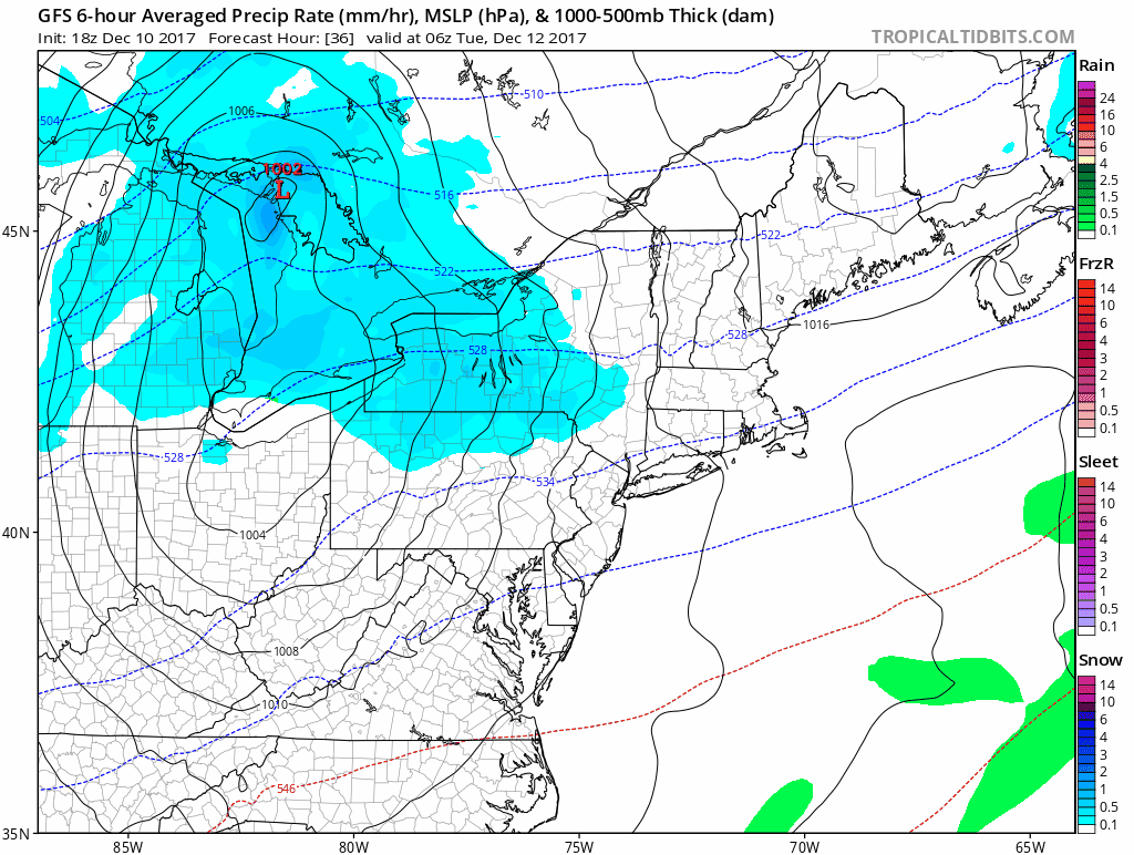
The precipitation should be pushing into the state during the early morning hours of Tuesday. There is currently a bit of uncertainty over temperatures on some of the guidance, but I think just about everyone away from the shoreline starts out as a period of snow during the pre-dawn hours and then changes to a mix and plain rain.
The precipitation should be pushing into the state during the early morning hours of Tuesday. There is currently a bit of uncertainty over temperatures on some of the guidance, but I think just about everyone away from the shoreline starts out as a period of snow during the pre-dawn hours and then changes to a mix and plain rain.
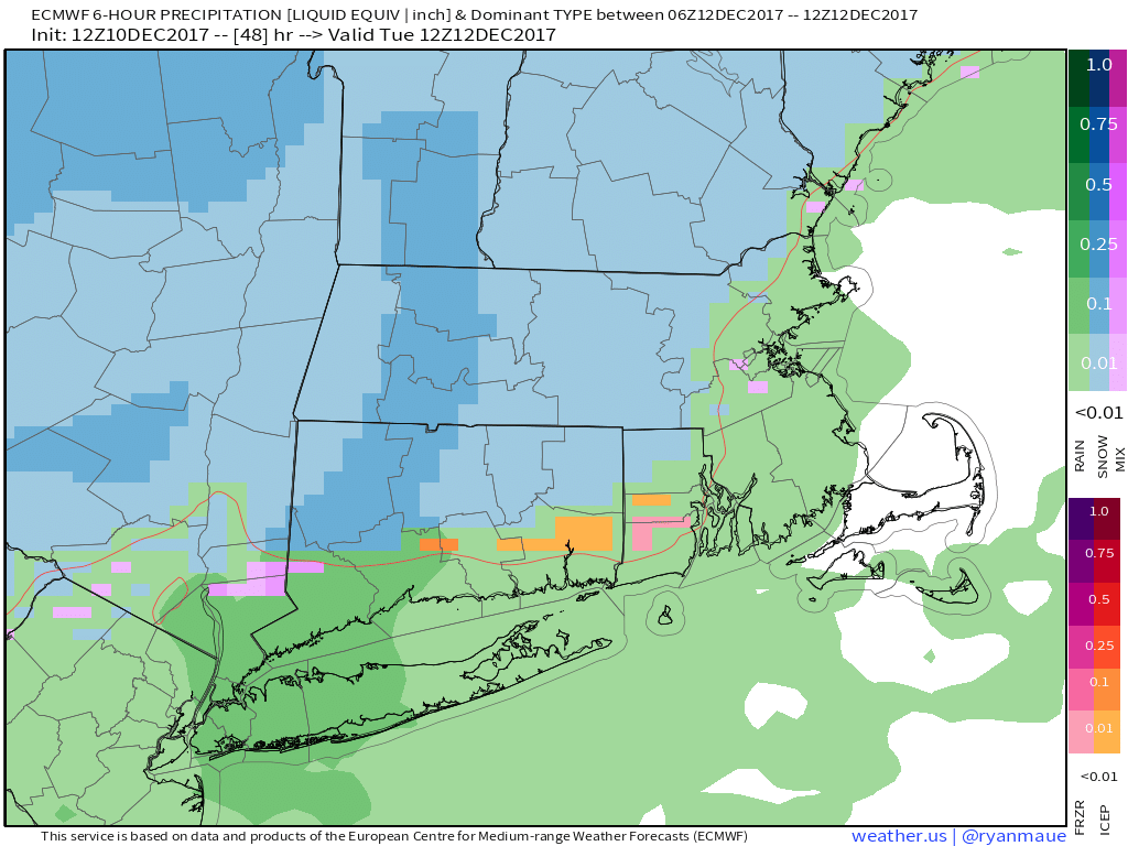
Euro depiction of precip on Tuesday morning. We still have a fair amount of uncertainty on how quickly the changeover happens. The later it is, the more impactful the event becomes.
With the track of the storm, I expect everyone to go to rain eventually. As usual, we have to watch for when the cold is scoured out, but I think we’ll see some delays (especially in northern CT) on Tuesday morning, but no real issues statewide by the evening commute.
I am holding off on talking too much about accumulation on purpose. Given the uncertainty I don’t want to speculate. I do expect a minor event away from the shore before a shift to rain but this could easily shift to a nonevent for most.
We may issue a map tomorrow if things seem more impactful.
GFS depiction of the Tuesday event.
Wednesday-Friday
Cold. The middle of the week brings an arctic blast that will make it feel like deep winter. Highs will struggle to reach freezing along the shore and inland areas will see the coldest daytime temps of the year so far. I’m going conservative with temps too. Get ready. By Thursday night, we’re watching another potential disturbance in the region. With the cold air in place, it could be a colder storm, if it happens at all.
Cold. The middle of the week brings an arctic blast that will make it feel like deep winter. Highs will struggle to reach freezing along the shore and inland areas will see the coldest daytime temps of the year so far. I’m going conservative with temps too. Get ready. By Thursday night, we’re watching another potential disturbance in the region. With the cold air in place, it could be a colder storm, if it happens at all.

European temps for Thursday. I'm going a bit higher, but if this verifies it will definitely feel like winter.
If things are delayed, Friday could also be a wintry day with the disturbance moving through the region. Timing and track are things we will need to watch we will need to watch. No sense in speculating too much more right now.
The Weekend
Right now, the weekend looks quiet and seasonably cold. It should be a decent time to get some holiday shopping in! It will feel like winter!
The Dailies:
Monday: Cloudy early with clearing and increasing clouds overnight. Highs in the mid 30s in the hills to low 40s at the shore.
Tuesday: Snow early changing to mixed precipitation and rain. Highs in the mid to upper 30s. Chance of precipitation 80%.
Wednesday: Sunny and cold. Highs in the upper 20s to low 30s.
Thursday: Sunny and cold with a chance of snow overnight. Highs in the upper 20s to low 30s. Chance of snow late 20%.
Friday: SCW period of interest. Snow. Highs in the upper 20s to low 30s. Chance of snow 30%.
Saturday: Sunny and seasonably cold. Highs in the mid to upper 30s.
Sunday: Sunny and slightly warmer. Highs in the upper 30s to low 40s.
As always, please like, share, and interact with us on our social media--on Facebook to share our discussions, and follow us on Twitter @southernctwx to retweet our posts. Hit the buttons below to join.
Thank you for reading SCW.
-DB
