Good evening from Southern Connecticut Weather!
We're excited to welcome a new forecaster to the SCW team! Greg Petridis is a degreed meteorologist with over ten years of experience forecasting for the NYC area. He has done extensive research in meteorology, especially in the field of analog based forecasting, and has used that information to produce consistently accurate long range seasonal forecasts and be one of the first to pick up on some of the areas largest snow events. You may remember him as the guest author of our 2014 summer outlook, and not only will he continue to contribute to our long range outlooks, but will join the rotation of operational forecasters as well, writing forecast discussions, producing maps, and being a general contributor to the SCW team. His discussions will be organized as first a forecast discussion and then summarized as a simple 7 day forecast, so if you're looking for a quick summary, scroll down to the end of the post. Please join Tim and I in giving him a warm welcome to the team!
-Spencer
Forecast Discussion Follows
Near normal temperatures are expected across the Nutmeg State for tomorrow and it should be a dry day. The next feature of interest is an Alberta Clipper system, slated to effect the state on Wednesday. The main questions are how much snow is going to fall and where the heaviest precipitation may be. It could even very well turn out that the heaviest precipitation is south of Connecticut, but there will likely be accumulations across most of the state regardless. Right now the thinking is that any snow that falls will likely fall from late in the afternoon on Wednesday and end before dawn on Thursday. So any areas that do get accumulating snow will likely see an impact on the evening rush hour. Right now, my general thinking, based on a consensus of computer modeling, is that an inch or two of snow should fall along the immediate south coast of the state, with up to an inch in the interior portions of Fairfield, New Haven, Middlesex, and New London counties, and just a flurry across Northern portions of the state.
As the Alberta Clipper moves Southeast out of the High Plains and rapidly moves into the Mid-Atlantic region later Wednesday, it will develop a coastal low offshore. A couple possible caveats to my forecast are: the clipper could go farther south, which would likely develop the coastal further south and east, and suppress nearly all of the accumulating snow south of Connecticut. Another potential is that the clipper could go a bit north of current guidance and be stronger, thus developing a coastal low quicker and further north and west. This would bring more snow to the state, and extend the axis of accumulating snow further north. At this time, rain really isn’t a concern, as the overall thermal profile looks cold enough to support all snow. The warmest computer model solutions indicate that temperatures in Southeastern Connecticut could rise above freezing, which could hamper accumulations. In that area, it may depend on the intensity of precipitation helping to cool the surface, as cooler air would be transported down from aloft. For now, my accumulation call looks good and I think this storm will have a minor impact on Wednesday’s evening rush hour.
After the clipper pulls out, Thursday should feature temperatures slightly cooler than normal, with a breeze, which could be quite gusty especially early. If the coastal low is slower to pull out or stronger than currently predicted, winds and perhaps some morning snow would last longer than currently predicted. But for now, the current thinking is that snow pulls out before dawn. Another weaker clipper system will move through on Friday, with just the chance for a brief flurry. Perhaps a brief heavier snow shower could occur over the Litchfield Hills on Friday.
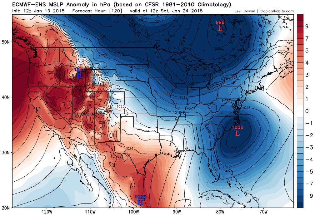
Attention then turns to a rapidly developing coastal low moving up the east coast over the weekend. Right now, most computer guidance keeps this storm far enough to the south and east of the area to keep measurable precipitation out of the region. However, there has been a noticeable shift northward in guidance today, which could bring measurable snow into the state, especially for residents of the south coast. For now, I’ll keep any mention of snow out of the forecast, due to the fact that the operational model consensus keeps precipitation south of the state. However, since guidance trended significantly northward today, it is prudent to keep an eye on the system, as adjustments further could very well be needed.
We're excited to welcome a new forecaster to the SCW team! Greg Petridis is a degreed meteorologist with over ten years of experience forecasting for the NYC area. He has done extensive research in meteorology, especially in the field of analog based forecasting, and has used that information to produce consistently accurate long range seasonal forecasts and be one of the first to pick up on some of the areas largest snow events. You may remember him as the guest author of our 2014 summer outlook, and not only will he continue to contribute to our long range outlooks, but will join the rotation of operational forecasters as well, writing forecast discussions, producing maps, and being a general contributor to the SCW team. His discussions will be organized as first a forecast discussion and then summarized as a simple 7 day forecast, so if you're looking for a quick summary, scroll down to the end of the post. Please join Tim and I in giving him a warm welcome to the team!
-Spencer
Forecast Discussion Follows
Near normal temperatures are expected across the Nutmeg State for tomorrow and it should be a dry day. The next feature of interest is an Alberta Clipper system, slated to effect the state on Wednesday. The main questions are how much snow is going to fall and where the heaviest precipitation may be. It could even very well turn out that the heaviest precipitation is south of Connecticut, but there will likely be accumulations across most of the state regardless. Right now the thinking is that any snow that falls will likely fall from late in the afternoon on Wednesday and end before dawn on Thursday. So any areas that do get accumulating snow will likely see an impact on the evening rush hour. Right now, my general thinking, based on a consensus of computer modeling, is that an inch or two of snow should fall along the immediate south coast of the state, with up to an inch in the interior portions of Fairfield, New Haven, Middlesex, and New London counties, and just a flurry across Northern portions of the state.
As the Alberta Clipper moves Southeast out of the High Plains and rapidly moves into the Mid-Atlantic region later Wednesday, it will develop a coastal low offshore. A couple possible caveats to my forecast are: the clipper could go farther south, which would likely develop the coastal further south and east, and suppress nearly all of the accumulating snow south of Connecticut. Another potential is that the clipper could go a bit north of current guidance and be stronger, thus developing a coastal low quicker and further north and west. This would bring more snow to the state, and extend the axis of accumulating snow further north. At this time, rain really isn’t a concern, as the overall thermal profile looks cold enough to support all snow. The warmest computer model solutions indicate that temperatures in Southeastern Connecticut could rise above freezing, which could hamper accumulations. In that area, it may depend on the intensity of precipitation helping to cool the surface, as cooler air would be transported down from aloft. For now, my accumulation call looks good and I think this storm will have a minor impact on Wednesday’s evening rush hour.
After the clipper pulls out, Thursday should feature temperatures slightly cooler than normal, with a breeze, which could be quite gusty especially early. If the coastal low is slower to pull out or stronger than currently predicted, winds and perhaps some morning snow would last longer than currently predicted. But for now, the current thinking is that snow pulls out before dawn. Another weaker clipper system will move through on Friday, with just the chance for a brief flurry. Perhaps a brief heavier snow shower could occur over the Litchfield Hills on Friday.
Attention then turns to a rapidly developing coastal low moving up the east coast over the weekend. Right now, most computer guidance keeps this storm far enough to the south and east of the area to keep measurable precipitation out of the region. However, there has been a noticeable shift northward in guidance today, which could bring measurable snow into the state, especially for residents of the south coast. For now, I’ll keep any mention of snow out of the forecast, due to the fact that the operational model consensus keeps precipitation south of the state. However, since guidance trended significantly northward today, it is prudent to keep an eye on the system, as adjustments further could very well be needed.
Regardless of what happens with the weekend system, Monday should clear out. Obviously, depending on the track of the coastal low, Monday could be colder and significantly windier than forecast. Stay tuned for updates!
Here is the seven day forecast for all of Connecticut:
Tuesday: Partly Sunny. Lows in the mid to upper 20s, and highs in the upper 30s to around 40.
Wednesday: Light snow likely along the south coast, tapering to just a chance of flurries in the north. One to two inches of accumulation possible along the south coast, to nothing in the north. Lows ranging from the upper teens to the mid 20s, and highs generally in the 30s.
Thursday: Gradual clearing. Lows in the mid to upper 20s, and highs in the mid 30s.
Friday: Mostly sunny. A chance of flurries in the hills. Lows in the mid 20s to around 30 and highs around 40.
Saturday: Cloudy. A chance of snow showers along the south coast. Highs in the low 40s and lows in the mid 20s to around 30.
Sunday: Clearing. Highs in the mid 30s to around 40 and lows in the mid 20s to around 30.
Monday: Mostly cloudy with a chance of flurries or snow showers. Lows in the mid teens to around 20 and highs in the low to mid 30s.
-GP
