Good evening to you from Southern Connecticut Weather!
We've got a tale of two regimes coming up this week, with the beginning of the week feeling like mid-summer with a combination of heat and humidity, and the end of the week being a return to seasonable and pleasant temperatures.
We'll start the week out with hot and humid weather, with highs in the mid to upper 80s expected for tomorrow, along a slight chance of showers and thunderstorms tomorrow afternoon, especially in the northern tier of the state. Any thunderstorms that develop should remain below severe level, but some brief downpours and gusty winds are possible. Otherwise, we'll have some fog and low visibility's to start the morning before the clouds burn off and we become mostly sunny over the course of the morning.
Tuesday will be similar feeling, if a bit less humid, but the skies will be cloudier, and the chance for thunderstorms a bit higher, with the best shot at any thunderstorm action again being across the northern tier. Again though, no severe thunderstorms are expected as of now.
We've got a tale of two regimes coming up this week, with the beginning of the week feeling like mid-summer with a combination of heat and humidity, and the end of the week being a return to seasonable and pleasant temperatures.
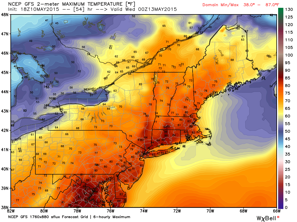
We'll start the week out with hot and humid weather, with highs in the mid to upper 80s expected for tomorrow, along a slight chance of showers and thunderstorms tomorrow afternoon, especially in the northern tier of the state. Any thunderstorms that develop should remain below severe level, but some brief downpours and gusty winds are possible. Otherwise, we'll have some fog and low visibility's to start the morning before the clouds burn off and we become mostly sunny over the course of the morning.
Tuesday will be similar feeling, if a bit less humid, but the skies will be cloudier, and the chance for thunderstorms a bit higher, with the best shot at any thunderstorm action again being across the northern tier. Again though, no severe thunderstorms are expected as of now.
The heat breaks Tuesday night as a cold front swings in from the west, dropping temperatures back down to below normal levels, with highs generally remaining in the 60s for Wednesday. The skies will bring a mix of sun and clouds. Seasonable weather continues through the end of the week into next weekend, with temperatures generally topping out each day a few degrees on either side of seventy, and sunshine for Thursday and Friday giving way to a chance of some precipitation for the weekend. That's a long ways out though, so keep an eye out on the page and site for a midweek update that will have a more in depth weekend forecast for you!
Have a fantastic week, and thank you for reading SCW!
-SA
Have a fantastic week, and thank you for reading SCW!
-SA
