Good evening from Southern Connecticut Weather.
A multi-hazard weather event is poised to impact Connecticut tomorrow and early Wednesday, as a rapidly deepening area of low pressure of the East Coast is expected to track toward the region and retrograde westward. While the rainfall potential has diminished based on recent trends, the wind threat has increased, especially along the coastline.
A multi-hazard weather event is poised to impact Connecticut tomorrow and early Wednesday, as a rapidly deepening area of low pressure of the East Coast is expected to track toward the region and retrograde westward. While the rainfall potential has diminished based on recent trends, the wind threat has increased, especially along the coastline.
- Flash flood watches are in effect for all of CT
- A Wind Advisory is in effect for Windham and New London counties as well as southern Middlesex county
- A Coastal Flood Advisory is in effect for the entire CT shoreline
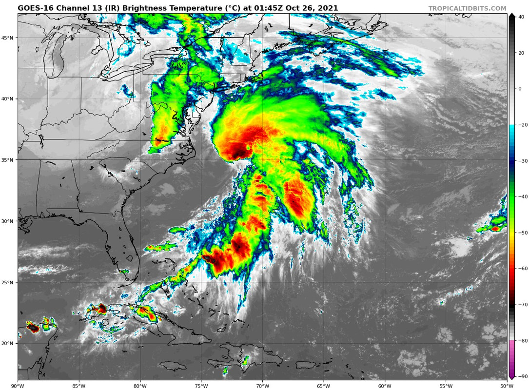
A recent infrared image of the developing storm. This is likely to be a hybrid low, with both subtropical and traditional nor'easter characteristics. This IR appearance is indicative of what will become a legitimately powerful storm tomorrow, with the two pieces of energy expected to phase.
The overall setup hasn't changed so let's get right to impacts.
Timing
Rain will become increasingly heavy overnight into the morning hours. That will likely make the commute slow going. I don't think there will be a lot of school cancelations, if any, because the worst of the winds will come tomorrow night. Both the wind and rain will diminish early Wednesday. It will not rain all the time tomorrow, but periods of moderate to heavy rain will be likely across the state.
Rainfall
We are taking down the rainfall forecast, especially for central and NE CT. Now we are expecting 2-5" of rain--still a lot--with the heaviest rainfall in SW CT. Basement flooding will be possible, and flash flooding will be possible across the state, especially in places where leaves may clog gutters. Stream and river flooding will be possible. The bulk of the rain will fall on Tuesday.
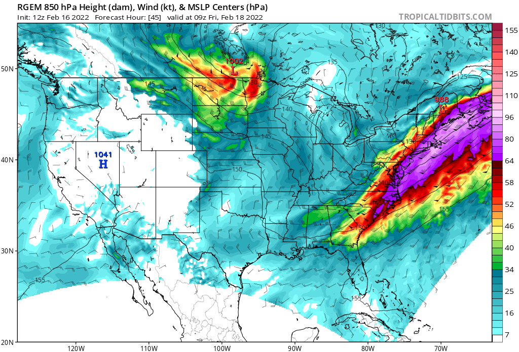
Below is the GFS depiction of the storm evolution. The worst of the rain is likely tomorrow morning into early afternoon.
The overall setup hasn't changed so let's get right to impacts.
Timing
Rain will become increasingly heavy overnight into the morning hours. That will likely make the commute slow going. I don't think there will be a lot of school cancelations, if any, because the worst of the winds will come tomorrow night. Both the wind and rain will diminish early Wednesday. It will not rain all the time tomorrow, but periods of moderate to heavy rain will be likely across the state.
Rainfall
We are taking down the rainfall forecast, especially for central and NE CT. Now we are expecting 2-5" of rain--still a lot--with the heaviest rainfall in SW CT. Basement flooding will be possible, and flash flooding will be possible across the state, especially in places where leaves may clog gutters. Stream and river flooding will be possible. The bulk of the rain will fall on Tuesday.
Below is the GFS depiction of the storm evolution. The worst of the rain is likely tomorrow morning into early afternoon.

Wind
This is where it has gotten very tricky. Yesterday, it seemed like the storm would stay far enough away to keep the low level jet (LLJ). Today the trend has been the opposite, with the storm retrograding west much closer to the state. There is even a hint of some mesolow development, which would be very effective in bringing strongest winds into the state.
For interior central and western CT--Litchfield, Hartford, interior Fairfield/New Haven counties--we are expecting maximum gusts between 35-45mph.
For Tolland, Windham, interior Middlesex/New London counties, we expect maximum gusts between 45-55mph.
For coastal New London County, we are expecting maximum gusts between 55-65mph.
This remains a tough forecast that is highly dependent on the specific storm track.
Power Outages/Impact
We think this will be a moderate impact event for most, and higher impact in far SE CT or eastern CT where we are likely to see higher wind gusts. Power outages are expected to be scattered in most of the state, with higher outages the further east and closer to the coast (especially SE CT) you are.
With most trees still leafed out, a stronger wind event could bring more widespread outages in the windiest spots, and a clean up day on Wednesday.
Below is a snapshot of the 18z Euro, which brings gusty conditions to much of the state late Tuesday.
As always, please like, share, and interact with us on our social media--on Facebook to share our discussions, and follow us on Twitter @southernctwx to retweet our posts. Hit the buttons below to join.
Thank you for reading SCW.
-DB
Thank you for reading SCW.
-DB
