Good morning from SCW.
With the exception of yesterday, what a stretch of weather! For much of the week, we saw sunny and seasonable conditions. Yesterday, we were dodging rain showers, with some staying in fairly persistent rain, and others longing for a little precipitation to wash away all the pollen.
Well, for the foreseeable future, rain chances will be low, as we finish the holiday weekend with dry conditions and go into the shortened work with with warmer and dry conditions until the end of the week. Let's dive in.
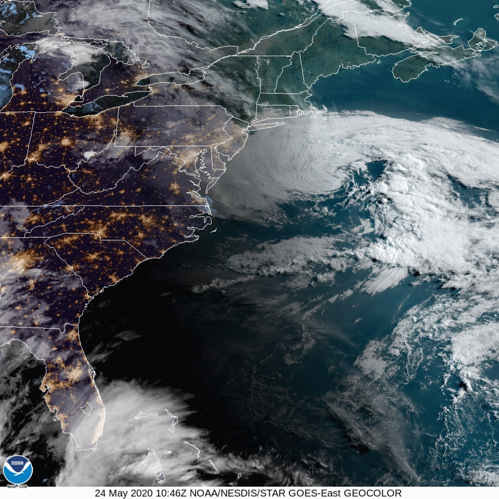
Fantastic imagery from GOES-E of the East Coast. Our storm from yesterday has pushed south, giving us a perfect Sunday. Overnight there is a small chance of some showers, but it's barely worth mentioning.
Monday
Memorial Day is the unofficial start to summer for many, and while it looks more cloudy than today, it will be dry with seasonable temperatures. Outdoor activities should be fine, and temperatures look to top out in the low 70s inland. Along the shoreline, it's the time of year where you need to watch out for sea breezes, which would keep temperatures a touch cooler than inland areas. Clouds should diminish over the course of the day, so it looks pretty good everywhere. Humidity does creep up a bit, but it's nothing bad.
Tuesday-Thursday
By Tuesday, our taste of summer begins. Clouds should diminish, and inland areas will see highs in the low 80s as a ridge of high pressure arrives. This isn't a "big heat" ridge, but it will feel like summer. Temperatures are a touch cooler at the shoreline, but still nice. With warmer temperatures, you will feel the humidity more each day, but it will still be manageable. Wednesday and Thursday look good, but the real humidity should arrive by Thursday. Thursday things begin to get more unsettled, as showers approach the region in advance of a cold front.
Right now, I think Thursday is mostly dry, but with a summer like pattern taking hold, I'll introduce some slight odds for showers and thunderstorms in case the front is a bit faster.
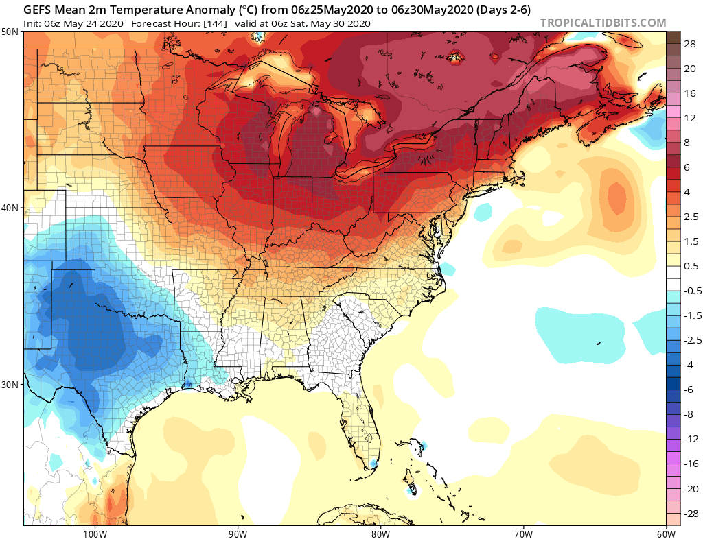
Above: the 06z GEFS depiction for temperature anomalies during the week. It's warmer than normal, which will make it feel like summer for this time of the year, but nothing outrageously hot.
Friday
Friday looks like the next real break in our nice weather. It'll be warm and humid, with mostly cloudy conditions and rain showers and thunderstorms. We'll see if these storms are more garden variety or stronger as we track the front and environmental conditions during the week. The bright side of this weather however is that cooler and less humid weather should arrive for the last weekend of May and meteorological spring!
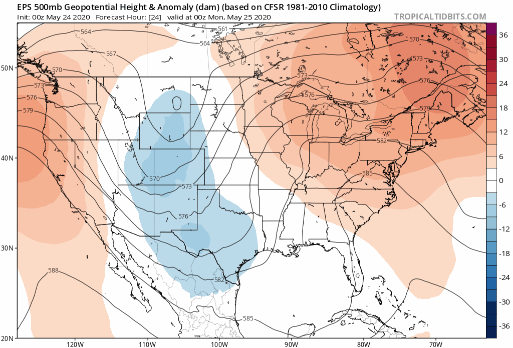
Above: The European ensemble (EPS) depiction of the upper level pattern during the week. Note the ridge of high pressure and how it eases toward the end of the week. Early June is looking more seasonable and less hot at this time.
Saturday-Sunday
Currently, a nice weekend is expected as the cold front passes on Friday and brings cooler and drier conditions. Right now, I expect much better humidity and sunny skies!
The Dailies
Monday: Mostly cloudy early, with decreasing clouds. Highs in the low 70s inland and upper 60s at the shore.
Tuesday: Mostly sunny. Highs in the upper 70s to low 80s inland and mid to upper 70s at the shore.
Wednesday: Mostly sunny. Highs in the low to mid 80s.
Thursday: Increasing clouds, warm and humid. Highs in the low to mid 80s inland and upper 70s to low 80s at the shore. Chance of showers 20%.
Friday: Mostly cloudy with showers and thunderstorms. Humid. Highs in the upper 70s to low 80s. Chance of rain 60%.
Saturday: Mostly sunny with seasonable temperatures and lower humidity. Highs in the mid to upper 70s.
Sunday: Mostly sunny. Highs in the low to mid 70s.
As always, please like, share, and interact with us on our social media--on Facebook to share our discussions, and follow us on Twitter @southernctwx to retweet our posts. Hit the buttons below to join.
Thank you for reading SCW.
-DB
