Disc: As the header implies, it looks more and more like Dec 2020 will be known as a wintry month across SNE, even if temps do end up above normal.
Currently: High pressure in control. Since the high is arced across N VA, winds will shift to the SW if they have not already. This is a warm wind direction for us, so the wx the next few days will be warmer. It is still a bit windy, with some leftover gradient from yesterday's clipper.
Tonight: I see no compelling reason to go below temp guidance tonight, since there will be warm air advection. So we'll expect lows of 30-35 degrees with pcldy skies.
Tomorrow: Well above norm temps and plenty of sun. No reason to quibble with guidance. Highs should be near 50.
Tomorrow night/Sat: Well above normal temps continue. Now looking at an earlier cold frontal passage, prob early Sun morn. This has implications down the road, which I will get to. Prob two rounds of showers: one around midday into the afternoon Sat, then another Sat night. I'll go below guidance temps Sat and keep highs near 50 again, due to arriving clouds and showers. This creates complications in the temp forecast. If showers arrive a few hrs later than fcst, my high temps could be at least 5 degrees too cool, but many will not complain!
Long Term: Long term concerns mainly focused on a potential major snowstorm for Wed, but there is some concern even before that for a coastal surprise.
First, for Sun, the faster frontal passage allows for Sun to be a better day than originally thought. With sun and delayed cold air advection, I've gone a bit below guidance, but even doing that allows for highs of 50-55 degrees.
The faster cold frontal passage allows more wave spacing for a potential coastal storm on Monday. For now, the guidance is out to sea, with the GFS way out to sea, and the Canadian and European solutions much closer, and "too close for comfort" at this range. P-type would be a bit tricky near the coast, as it is uncertain if there would be enough cold air yet. For now, the forecast for Monday will be left dry, with the options for later crews to refine this thinking, in case models come further west with that system. Just wanted to get this out there!
So for Monday, assuming the forecast is dry, I'll still go below guidance, assuming that the cold air advection is stronger than modeled, and we at least get some high clouds from the offshore low. A chilly day, with highs near 40.
Tuesday is definitely a fair day, in between systems. Meanwhile, the offshore low gets to become the 50/50 low which will help keep the next system far enough south and east to keep it a snow track for our area, at least according to today's modeling- more on that in a little bit. I'll go closer to guidance, but still a deg or two blw, and that yields highs in the low 40s.
Now for the Wed-Thu timeframe. Two out of the "big three" computer models and all 3 ensemble solutions have pretty much converged this afternoon on a solution that would bring a major snowstorm to the state. There are many things that would favor this solution already, including: A big ridge out west, a 50/50 low (that is a low pressure system near 50 deg N, 50 deg W), a -NAO (high press over Greenland), and sufficient cold air in place, and a large sfc high over Srn Canada. All global models except the operational Canadian are in good agreement now. The operational Canadian is out to sea. Since the conditions favor the storm, it may be possible to have higher than normal confidence that a significant wintry event is brewing for the area. What I mean by this is, when you have so many favorable conditions in place, they don't usually disappear. In fact, this is often the way meteorologists diagnose the models: You check to see if the conditions are in place to produce the snowy modeled outcome. Generally, there are three possibilities when doing this. The first is that YES, the majority of the conditions line up, so that it would take A LOT of changes to make this a zero. The second is CONDITIONAL, where some of the conditions line up, but conditions can change. The third is NO, the storm is probably bogus, because conditions do not support the storm. Examining the models yields solution number one.. conditions are a go for the POTENTIAL for at least a good snowstorm for the area.
Now here is the main caveat. We are still 6 days out. A lot can change. All of the assumptions above are AS MODELED. If the high pressure or 50/50 low are not in the same spot or strength, the system could be warmer and ptype issues would arise. A stronger, more suppressive 50/50 low could push the storm out to sea. However, for a 6-day lead time, looking at today's guidance, confidence has to be much higher than normal in at least seeing a few inches of snow for the area.
Because of all of this, and with the assumption that at least some of the period from Wed morn to Thu morn will have snow falling, I have basically ignored the temp guidance at that range, and we'll just call it 30 to 35 degrees for highs.
Looking into the longer range, the pattern continues to remain very active, with some type of at least minor wave in the flow every 60 hrs or so. When there is enough cold air avail, and the storm follows a good track, frozen ptypes will be favored.
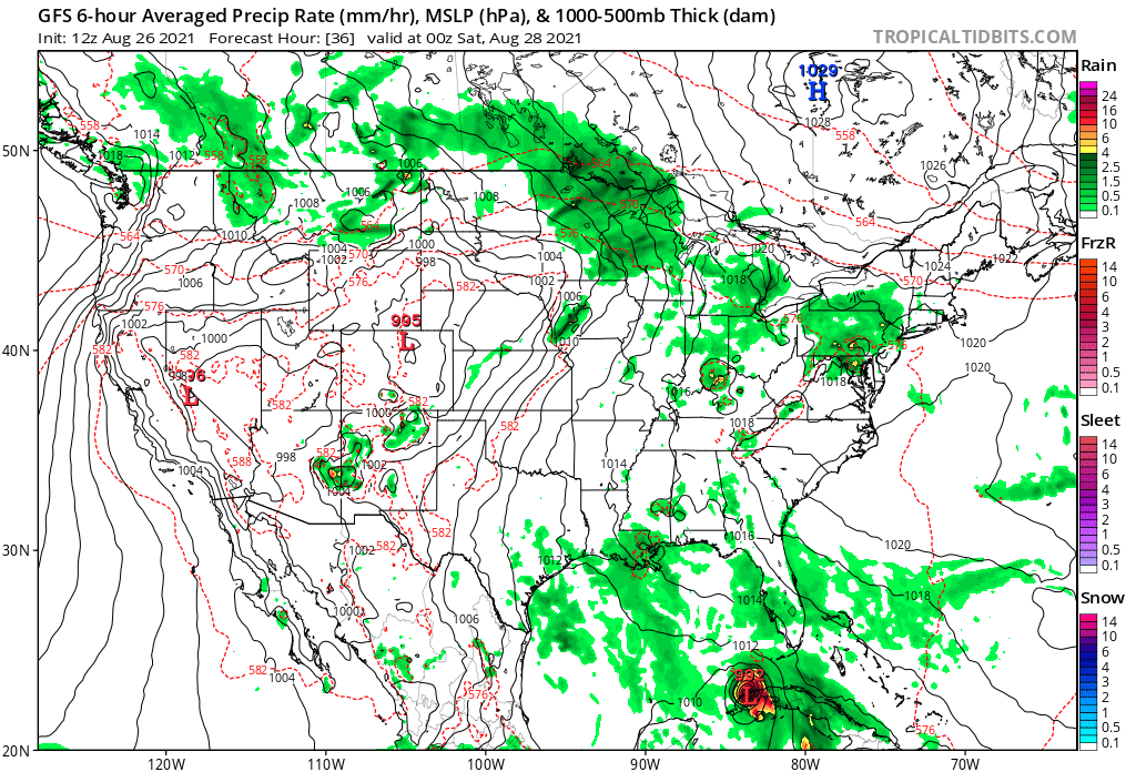
Now, let's take a look at the systems that could affect the area in the coming days. I'll show the showers for Sat, and then of course, the potential snowstorm for Wed. You can see from the map below, valid midday Sat, that there is a coastal front setting up, and there is rain along the coast moving N into CT.
Currently: High pressure in control. Since the high is arced across N VA, winds will shift to the SW if they have not already. This is a warm wind direction for us, so the wx the next few days will be warmer. It is still a bit windy, with some leftover gradient from yesterday's clipper.
Tonight: I see no compelling reason to go below temp guidance tonight, since there will be warm air advection. So we'll expect lows of 30-35 degrees with pcldy skies.
Tomorrow: Well above norm temps and plenty of sun. No reason to quibble with guidance. Highs should be near 50.
Tomorrow night/Sat: Well above normal temps continue. Now looking at an earlier cold frontal passage, prob early Sun morn. This has implications down the road, which I will get to. Prob two rounds of showers: one around midday into the afternoon Sat, then another Sat night. I'll go below guidance temps Sat and keep highs near 50 again, due to arriving clouds and showers. This creates complications in the temp forecast. If showers arrive a few hrs later than fcst, my high temps could be at least 5 degrees too cool, but many will not complain!
Long Term: Long term concerns mainly focused on a potential major snowstorm for Wed, but there is some concern even before that for a coastal surprise.
First, for Sun, the faster frontal passage allows for Sun to be a better day than originally thought. With sun and delayed cold air advection, I've gone a bit below guidance, but even doing that allows for highs of 50-55 degrees.
The faster cold frontal passage allows more wave spacing for a potential coastal storm on Monday. For now, the guidance is out to sea, with the GFS way out to sea, and the Canadian and European solutions much closer, and "too close for comfort" at this range. P-type would be a bit tricky near the coast, as it is uncertain if there would be enough cold air yet. For now, the forecast for Monday will be left dry, with the options for later crews to refine this thinking, in case models come further west with that system. Just wanted to get this out there!
So for Monday, assuming the forecast is dry, I'll still go below guidance, assuming that the cold air advection is stronger than modeled, and we at least get some high clouds from the offshore low. A chilly day, with highs near 40.
Tuesday is definitely a fair day, in between systems. Meanwhile, the offshore low gets to become the 50/50 low which will help keep the next system far enough south and east to keep it a snow track for our area, at least according to today's modeling- more on that in a little bit. I'll go closer to guidance, but still a deg or two blw, and that yields highs in the low 40s.
Now for the Wed-Thu timeframe. Two out of the "big three" computer models and all 3 ensemble solutions have pretty much converged this afternoon on a solution that would bring a major snowstorm to the state. There are many things that would favor this solution already, including: A big ridge out west, a 50/50 low (that is a low pressure system near 50 deg N, 50 deg W), a -NAO (high press over Greenland), and sufficient cold air in place, and a large sfc high over Srn Canada. All global models except the operational Canadian are in good agreement now. The operational Canadian is out to sea. Since the conditions favor the storm, it may be possible to have higher than normal confidence that a significant wintry event is brewing for the area. What I mean by this is, when you have so many favorable conditions in place, they don't usually disappear. In fact, this is often the way meteorologists diagnose the models: You check to see if the conditions are in place to produce the snowy modeled outcome. Generally, there are three possibilities when doing this. The first is that YES, the majority of the conditions line up, so that it would take A LOT of changes to make this a zero. The second is CONDITIONAL, where some of the conditions line up, but conditions can change. The third is NO, the storm is probably bogus, because conditions do not support the storm. Examining the models yields solution number one.. conditions are a go for the POTENTIAL for at least a good snowstorm for the area.
Now here is the main caveat. We are still 6 days out. A lot can change. All of the assumptions above are AS MODELED. If the high pressure or 50/50 low are not in the same spot or strength, the system could be warmer and ptype issues would arise. A stronger, more suppressive 50/50 low could push the storm out to sea. However, for a 6-day lead time, looking at today's guidance, confidence has to be much higher than normal in at least seeing a few inches of snow for the area.
Because of all of this, and with the assumption that at least some of the period from Wed morn to Thu morn will have snow falling, I have basically ignored the temp guidance at that range, and we'll just call it 30 to 35 degrees for highs.
Looking into the longer range, the pattern continues to remain very active, with some type of at least minor wave in the flow every 60 hrs or so. When there is enough cold air avail, and the storm follows a good track, frozen ptypes will be favored.
Now, let's take a look at the systems that could affect the area in the coming days. I'll show the showers for Sat, and then of course, the potential snowstorm for Wed. You can see from the map below, valid midday Sat, that there is a coastal front setting up, and there is rain along the coast moving N into CT.
Finally, this map is valid midnight Wed night... a snowlover's dream if this came true! However, it's still a long way from now!

Anyway, that's all for now, see you next week, or maybe earlier if conditions warrant and my time allows!
-GP!
-GP!
